15483 posts
Welcome to MySwissAlps Mujing!
All our hikes at http://www.myswissalps.com/hi king are based on kml files, but we don’t have a direct link to those files on our pages. There might be software which can extract it from the page, but I am not familiar with that.
Here’s an example:
myswissalps-doc.r.worldssl.net/doc s/default-source/trail-coordinate-files/bettmerhorn-marjelensee-fiescheralp.kml?sfvrsn=6
(this link will only work until the next map update though).
Is there a specific one you’re interested in?

72625 posts
Arno,
Thanks for your reply.
I plan to hike two trails:
Railway discovery trail from Kandersteg to Frutigen
and
Route details of the Lötschberg southern ramp
It would be great if you could get me the KML files of these two trails.
Mujing
15483 posts
Hi Mujing,
Sure, here are the links to more details and to the KML files:
72625 posts
Arno,
I downloaded the two KML files and had them then converted to PDX with an online convertor:
kml2gpx.com
I successfully imported the two PDX files into my Motion X on my iPhone.
You are great. Thanks a lot.

7567 posts
Hi Mujing –
http://www.myswissalps.com/fo rum/topic/bls-sudrampe-trail
SwissTopo has an app for smartphones.
shop.swisstopo.admin.c h/en/
It might be an effective substitute or supplement for the work for conversion. Selections can be saved for offline use, but I believe that there is a modest fee for that capability.
Check out the options on this page, including the tab for online data.
Slowpoke
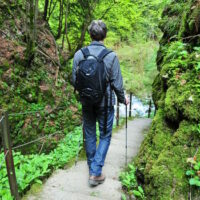
72625 posts
Slowpoke,
Thanks for sharing the picture of the trail from Hohtenn to Lalden. I will definitely check the swisstopo link up.
Mujing


