
72625 posts
Hi SteveP,
I haven’t done this hike yet, but I’ve found this information for you: http://www.jungfrau.ch/en-gb/kleine-scheidegg/eiger-trail/. There is a downloadable map, which shows the closed and the new trail. Maybe this helps a bit.
Hopefully, other travelers have already done this trip and will share their personal experiences. If not, I would suggest you to write an email to info@jungfrau.ch.
804 posts
Hi Steve
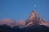
i have done the hike several times but not since the construction began but you can see the trail from just below Eigergletscher station off to the right as you look down the mountain. It is the only trail that goes to the right toward the base of the Eiger. Once you are on the trail there are no other side trails or forks. The terrain is wide open with no trees so you can easily see where you are going and pretty much impossible to get lost.
Mark

7567 posts
Hi Lidiko-
The link to open the map inside your link:
http://www.jungfrau.ch/en-gb/kleine-scheidegg/eiger-trail/
does not work for me. I cannot get the map. Is it just my browser? Can you open the map?
Slowpoke
72625 posts
Hi Slowpoke,
I do not understand, it opens me very well. I use Chrome. But anyway, I’ve attached it for you. 🙂
Ildiko
7567 posts
Hi Ildiko –
<<“But anyway, I’ve attached it for you. :)”>>
Merci vielmal!
That works for me. The link I got from your earlier post opened but did not show the new route, only the old one.
I am reminded that the overall altitude change is approximately 800 meters descent. For some, that might be hard on the knees.
<<“Distance 6.03km
Duration 2h 50m
Ascent 80m
Descent 783m”>>
Slowpoke
4 posts
My wife and I just hiked the Eiger Trail two days ago. It is well marked, you will have no problem staying on the trail.
72625 posts
Thank you Montana Mike for the information and also welcome to MySwissAlps! 🙂
72625 posts
Thanks everyone for the excellent info on the Eiger Trail. Because of the forecast of snow next week in that area, I may need to delay my hike for a few days.
7567 posts
Hi SteveP-
Don’t know if this will help, but it might.
en.swisswebcams.ch/suc he/ort/kleine%20scheid egg-2660145/
Slowpoke


