
72625 posts
I think the free maps that are available all over town, but especially at the lift locations is more than adequate for all of the excellent scenic hikes on the Schilthorn side. But if you really want a detailed map the sport shops around town will sell them.
15484 posts
Hi Ruby,
This page will help you out I think: http://www.myswissalps.com/hi king/maps.

26 posts
hi
for an online map you cannot do better than map.schweizmobil.ch/
have fun

383 posts
A great map, especially when you zoom it all the way. I could even find my grandmother’s house!
72625 posts
Hi Ruby
In case it helps, you also have some hiking ideas on this link searchable by area and level of difficulty: http://www.myswissalps.com/hi king
Also links to the areas you’re visiting:
All the best for your journey!
Maria.
72625 posts
Levgon is right that you can buy the area paper map in Muerren at many shops, but if you’d like to get one ahead of time, to facilitate your planning/dreaming, you can order the Muerren Swiss topo map (#1248), at http://www.swisstopo.ch, or on http://www.amazon.de/1248-Mürren-topographische-Wanderkarte-Schweiz/dp/960212279X/
Swiss paper maps are way better than digital, in this old hiker’s humble opinion. Analog will never die!
NTL
72625 posts
279 posts
Hi.
The hardcore topographic maps published by the Bundesamt fur Landestopographie are the pinnacle of the map makers art. You can get them from most outdoor sports shops in Switzerland.
The best sheet for you would probably be the 1:25000 Lauterbrunnen map, Blatt (sheet) 1228, or the 1:25000 Jungfrau Region, Blatt 3084.
Cheers
Alan
82 posts
This one is amazing (all the trails, altitudes, public transportation, and tons more) and it is a free download from the IOS app store for my ipad, and search parameters are in English. Its called SwitzerlandMobility.
10 posts
That’s a great map very useful – many thanks for the link

7567 posts
Hi Ruby-
You got lots of good information; some of it redundant.
This is best map…others use the same data:
map.geo.admin.ch/?topic=swisstopo&lang=e n&bgLayer=ch.swisstopo .pixelkarte-farbe&layers=ch.swisst opo.swisstlm3d-wanderwege&zoom=5&E=26 33670.69&N=1159241.27
Color coding explained:
http://www.alpenwild.com/stat icpage/trail-signs-in-the-swiss-alps/
Paper maps, with the I.D. numbers noted by others, ,are available from SwissTopo, but can almost always be purchased at stores in the region of interest. Wanderkarten have trails marked..at 1:50,000 and some 1:33,000. The really detailed 1:25,000 do not, as far I know, show the marked Wanderwegen.
shop.swisstopo.admin.c h/en/products/maps
If you come in through Zürich main station, stop at Barth Buecherei for paper versions. They carry a full, set.
Slowpoke
7567 posts
<<“We’ll be vacationing in Murren in June and are looking forward to doing a fair amount of hiking while we’re there.”>>
I hope it is late June. Early June often ( but not always) has poor hiking. Still snow, slush, and potential avalanches in early June at higher altitude.
Most years, that is….some are better, some are worse.
Slowpoke
72625 posts
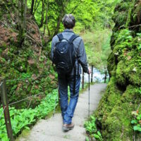
I know that you didn’t ask for this, but I feel strongly that I must offer this advice. I would highly recommend trying to get to the Wasenegg ridge and Sprutz falls (can be same hike) Wasenegg is on a knife’s edge ridge, very dramatic and you can walk behind the falls for some nice photos.
Another hike may require a car, but it’s worth the effort. Get to the Isenfluh cable car (tiny charming cars, worth the trip alone) and take it up to Sulwald. Then hike to the Lobhornhutte for homemade soup and a beer. Stunning hike!
You have probably already seen this site, but it has a copy of the free maps available around town and some recommended hikes http://www.gimmelwald.com/hik es.html The routes are very well marked, so unless you are planning some very rigorous hikes out into the wilderness or just want a nice souvenir, I think the free map is adequate


