
72625 posts
Hi Briesimons and welcome to MySwissAlps!
I haven’t been on the hike – but there is a good website with details that can help you here: https://activityworksh op.net/hiking/alpinepa ssroute/
You will come across trains and other forms of transport on your walk.
Lucas
279 posts
Hi Briesimmons,
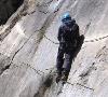
I did this walk about 20 years ago and there are a couple of cable ways that can speed things up.
The first would be the gondola from Engelberg to Truebsee, which is about halfway up Mt Titlis. The vertical difference is about 800 metres, so that will save you a lot of time. Next to the Truebsee Gondola is the Truebsee Hopper, which is a chair lift that runs in 3 stages down to Enstlenalp. Technically, it is a ski lift and may not run in the summer, however, when I was there it had snowed heavily for several days (in the middle of July) and the lift was operating to bring a large school party up from the other side and I managed to catch a ride in the opposite direction.
The hike out of Meiringen is a bit steep at the beginning. You can catch the historical cable train that runs up to the Reichenbach Falls and bypass the steepest part of this leg.
There are no cableways between the Reichenbach Falls and Grindelwald. There is a Post Bus on that route, but the walking is easy enough if you have enough time.
From Grindelwald to Lauterbrunnen there are all sorts of options. The walk up to Kleine Scheidegg isn’t very steep, but it is quite long, so if you want to speed up the process, you can take the train to Kleine Scheidegg, or the Gondola from Grund to Männlichen and walk down from there. If you are feeling particularly lazy, there is a cable car that runs from Männlichen to Wengen, which is about half way from KS to Lauterbrunnen.
This Youtube clip is a virtual tour I put together for a friend that covers most of your proposed walk.
http://www.youtube.com/watch?v=_Npea2RYD-g
HAve Fun!
Alan

8889 posts
Wow Alan – Awesome video!
279 posts
Thanks Rockoyster – glad you liked it.
This is another one I made. It’s a bit jerky in places, but it gives a good sense of scale.
https://youtu.be/sZsp8dOx6MA
Cheers
Alan
8889 posts
Love your work Andrew. The sheer scale of everything is amazing.

7567 posts
Hi Briesimons-
Perhaps a look at a couple of maps would help.
Mapsearch.CH is good for transport connections ( turn on ‘Traffic” under “Points of Interest” then zoom in and mouse over the icons).
and, for exquisite detail, Swisstopo, which does show the altitudes:
map.geo.admin.ch/?topic=ech&lang=en&bgLa yer=ch.swisstopo.pixel karte-farbe&layers=ch.bav.ha ltestellen-oev,ch.swisstopo.swiss tlm3d-wanderwege&X=178815.17 &Y=659289.08&zoom=4
The total route can be found on this website, if you can figure out how to get to it. All sorts of info about relevant details.
map.wanderland.ch/?lang=de&route=all&bgLa yer=pk&resolution=50&X =650600&Y=172800&layer s=Wanderland
Clicking on a route seems to a viable approach…most of the time. Also, searching on the names of towns along the route.
Slowpoke
72625 posts
Thanks so much, this is great help!!


