Lugano-Gandria: the facts
- Hiking time: 1h40
- Difficulty: easy
- Elevation: 272 – 361 m
- Distance: 5.5 km
- Terrain: across a town, along a lake
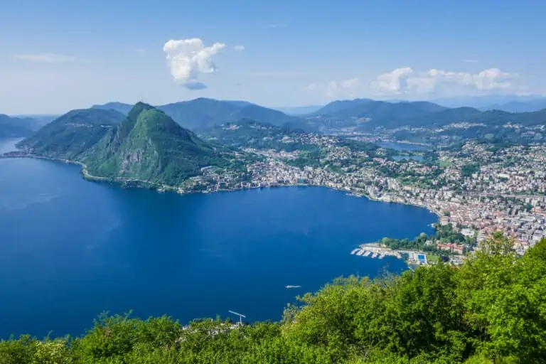
- Region: Lake Lugano (Ticino)
About this trail
You’ll first walk across the city center of Lugano, where you will soon reach a park on the lake. After an optional side trip with the funicular to Monte Brè, you’ll continue your way to the village of Castagnola to pick up the Olive Tree Path (Sentiero dell’Olivo) along the lake to the ancient town of Gandria.
This route includes the majority of the Olive Tree Path, which is dedicated to the olive groves which were once much more prominent in this area. Take your time to explore Gandria. It is a tiny car-free town, with narrow picturesque streets and alleys.
Directions and map
How to reach Lugano
Lugano can best be reached by train, as explained here.
How to travel back from Gandria
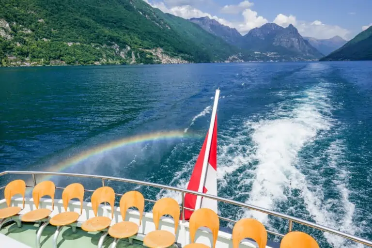
From Gandria, you can get back by boat (which is the most scenic option), or by bus.
The hiking route, section 1: Lugano-Cassarate
You can find the route on the map below. We offer detailed street-by-street directions as well:
- Exit the Lugano station by taking the stairs down to the city from the station hall. Alternatively, you can take the funicular.
- Walk down through the Via Cattedrale. Cross the square (Piazza Cioccaro), and turn right into Via Pessina.
- At the end of the street, turn left into Via Nassa. Cross the square (Piazza Riforma) and walk straight ahead into the Via Canova.
- With a small park on your left, cross the street to enter a bigger park, the Parco Ciani.
- Follow the path in the park until you can turn right onto the bridge crossing the canal (see the map).
- Walk straight ahead on Viale Castagnola for about 650. Go left into the small street Via Funicolare, with a small park and a little ancient church on the left.
- Turn left after the church, then immediately right up the stairs into the Salita Vallée to continue the hike. Alternatively, you can board the funicular for a visit to Monte Brè.
The hiking route, section 2: Cassarate-Gandria
- Follow the footpath until you reach the street in the village of Castagnola.
- Follow this street for about 200 m, then turn right into the narrow street Salita degli Olivi going down the hill. Alternatively, there is a path going up the hill, which leads to Gandria too, but takes much more time. Do not take this path if you want to stick to the suggested route.
- Cross the street and continue on the Salita degli Olivi to reach the small square Piazza Carlo Cattaneo.
- Enter the Via Giacomo Discepoli and follow it for about 250 m. Then turn right into the Viottolo delle Agavi, which will take you to a parking lot on Lake Lugano.
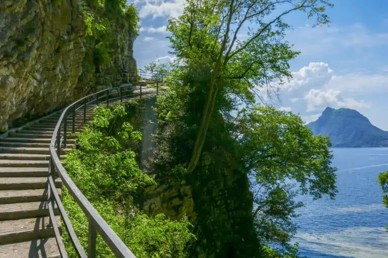
- Follow the path (Sentiero di Gandria) along Lake Lugano, until you reach the town of Gandria.
- Take some time to explore the narrow streets of Gandria before taking the boat or bus back.
Map: Olive Tree Path hiking route Lugano-Gandria

Promotions 

Up to 50% off selected activities in Switzerland and Italy. Check the website for details.


Nearby activities: boat rides and Monte Brè
Boat Lake Lugano
Other blog posts you may like
Hike Täsch-Zermatt
Hike First-Grosse Scheidegg