

Rigi Kaltbad-Rigi Scheidegg: the facts
- Hiking time: 2h00
- Difficulty: easy
- Elevation: 1430 – 1641 m
- Distance: 7.1 km
- Terrain: broad path across mountain meadows and some forest
- Region: Lake Lucerne
About this trail
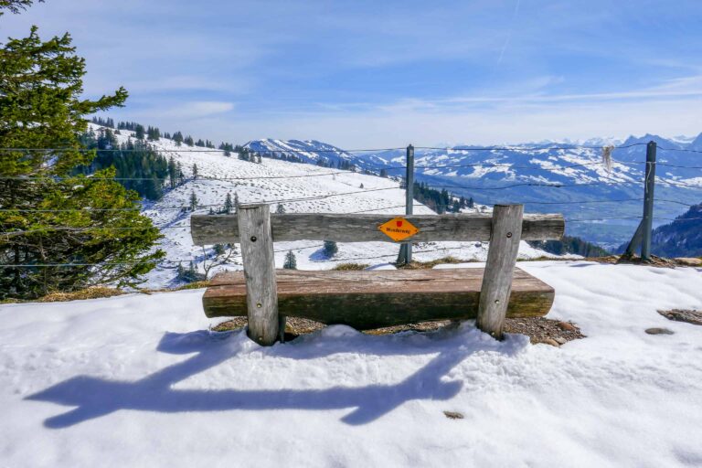
The panorama path between Rigi Kaltbad and Rigi Scheidegg is one of the prettiest hiking routes in Switzerland. A railroad once connected both locations in the hills north of Lake Lucerne. The train stopped operating in the early 20th century. Nowadays, the hiking path literally follows the track of this former railroad.
This broad and easy path is suitable for nearly all hikers. In about 2 hours you’ll explore the beautiful hills of the Rigi. With each step and turn, you’re rewarded with far-reaching views over Lake Lucerne in the south and the mountains south, east, and north of this area.
Directions and map
The below directions assume you walk from Rigi Kaltbad to Rigi Scheidegg, but you can enjoy this route in the opposite direction just as well.
How to reach Rigi Kaltbad
You can reach Rigi Kaltbad by cable car from Weggis or by cogwheel train from Vitznau. Please find details here.
How to travel back from Rigi Scheidegg
Take the cable car down to Kräbel and switch to the cogwheel train to Arth-Goldau. From Arth-Goldau you can continue your journey by train to Lucerne or to other directions. Mind checking the operation dates of the cable car: there are maintenance breaks in April and November. Find details here.
Hiking directions
First, follow the signs to Rigi First. Then keep heading for Rigi Scheidegg.
Map with the trail between Rigi Kaltbad and Rigi Scheidegg

Promotions 

Members-only promotion

This promotion is available to members only. Check out all the benefits members have access to.
Rigi
Lake Lucerne

Free with the Swiss Travel Pass in Lucerne

Hike Täsch-Zermatt

