

Bettmerhorn-Märjelensee-Fiescheralp: the facts
- Hiking time: 2h45
- Difficulty: moderate
- Elevation: 2180 – 2647 m
- Distance: 9.3 km
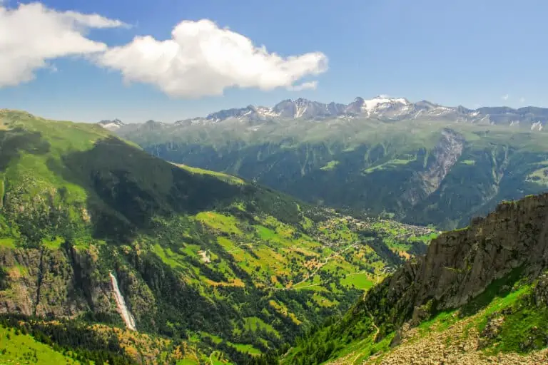
- Terrain: rocky, high-alpine area with grasslands, mountain lakes and meadows
- Region: Upper Rhone Valley (Valais)
About the trail
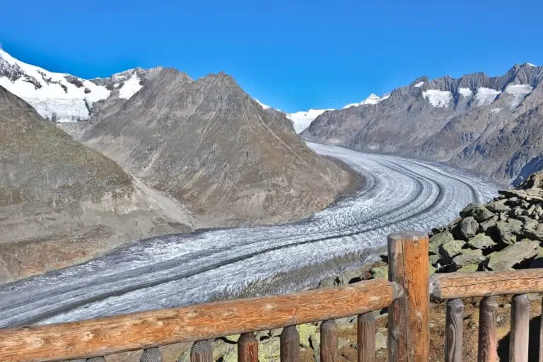
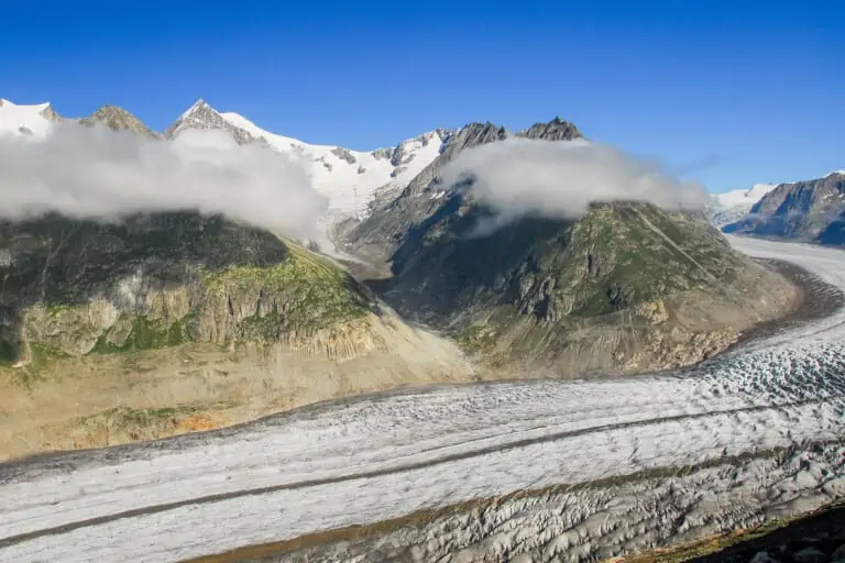
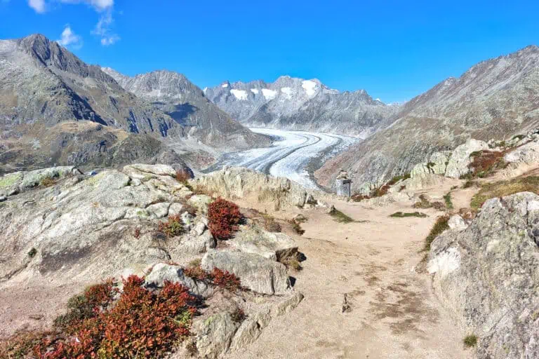
The cable car takes you up to the Bettmerhorn, where you can immediately enjoy the magnificent view of the Aletsch Glacier. The route can be divided into 3 sections: along the glacier (1), crossing over to the Upper Rhone Valley (2), and the Upper Rhone Valley (3).
- Section 1 is about 3.5 km long and offers continuous views of the glacier as you walk parallel to it. Then you’ll walk to the east, away from the glacier, and you’ll soon reach the tiny Märjelensee (Lake Märjelen).
- Section 2 continues to the larger Vordersee (Lake Vorder), where you will enter the 1 km-long pedestrian tunnel. It’s quite exciting to walk across that pretty dark tunnel. A flashlight will come in handy. You can extend the route by not taking the tunnel but walking further to the northeast along the Vordersee. This trail rejoins with the original route about 1 km before Fiescheralp.
- Section 3 starts at the end of the tunnel. This section offers views of the Fiescher Glacier, the Fiescher Valley, and the Upper Rhone Valley. An easy wide trail will lead you to Fiescheralp. If you want to see the Aletsch Glacier from a different perspective, this is where you can take a cable car up to the Eggishorn.
Directions and map
How to reach the Bettmerhorn
Travel to the Bettmerhorn as explained here.
How to get back from Fiescheralp
Take the cable car down to Fiesch. You’ll arrive right next to the rail station of Fiesch. See here for further details.
Route description
Simply follow the signs to Märjelen and Fiescheralp.
Map with the Bettermerhon-Fiescheralp hiking trail
Maps are available to members only
Check out all the benefits members have access to

Promotions 

Switzerland & Italy Spotlight Week
This promotion ends 13 May 2024
Up to 50% off selected activities in Switzerland and Italy. Check the website for details.

Our info about the Bettmerhorn, the glacier, and the Valais
Bettmerhorn
The cable car trip up the Bettmerhorn ends at a remarkable location with magnificent views of the Aletsch Glacier. Learn …
Aletsch Glacier
The Aletsch Glacier is the largest glacier of Switzerland and even of the Alps. We explain how to get the …
Other blog posts you may like
Gornergrat, Matterhorn Glacier Paradise, Sunnegga-Rothorn
Gornergrat, Matterhorn Glacier Paradise and Sunnegga-Rothorn: three beautiful mountain excursions from Zermatt. This is how to choose, or how to …
Hike Täsch-Zermatt
Walk along the railroad in the Matter Valley to the famous mountain resort Zermatt.
Hike First-Grosse Scheidegg
Easy walk across alpine meadows with great views of the Jungfrau massif. You can continue by bus or on foot …

