 Min. time required: 1:00
 Season: all year
 Recommended season: all year
 Max. altitude: 225 m (738 ft)
About this Locarno city walk 
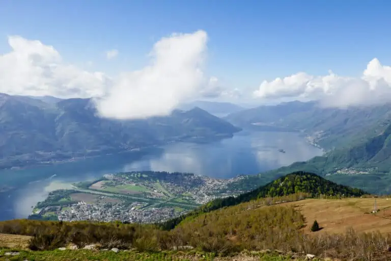
This self-guided walking tour in Locarno covers 4.1 km and takes about 1 hour, excluding breaks. The route will take you along the lake, town square, shops, small parks, the Visconteo castle, and the Sant' Antonio church.
Allocate 2 to 4 hours to this activity if you plan to take pictures, have a break, and perhaps browse a few of the many shops in Locarno.
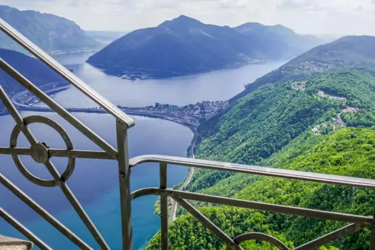
This walk can be combined with a boat trip on Lake Maggiore, a visit to the Madonna del Sasso church or a mountain ride to Cardada-Cimetta.
Prices for the walk
The walk: free
The hiking route in Locarno is free.
Tickets to travel to Locarno
If you're not staying in Locarno you'll have to get there first. We advise you to travel by train. Rail passes can allow discounted or free traveling to Locarno. Without one, you'll have to buy regular tickets.
Find other Locarno tours

Offered by MySwissAlps: www.myswissalps.com
- Offer from one of our best partners.
- Extra Support: MySwissAlps can assist if you have questions about your order.
Offered by MySwissAlps: www.myswissalps.com
- Offer from one of our best partners.
- Extra Support: MySwissAlps can assist if you have questions about your order.
Offered by MySwissAlps: www.myswissalps.com
- Offer from one of our best partners.
- Extra Support: MySwissAlps can assist if you have questions about your order.
Promotions
There are currently no promotions available.
City hike directions and map
How to get to Locarno
The train is the best way to travel to Locarno. This walk starts at the train station. Learn more about traveling to and in Locarno here.
Walking route directions
Find the route on the map below and use these step-by-step directions.
Section 1: the town center
- Exit the train station and follow the Via della Stazione towards the town center (to the south).
- You'll cross a bridge over a canal and pass the funicular station to Madonna del Sasso on your right. Now turn right into the shopping street Via alla Ramogna.
- Keep walking straight ahead until you reach the curved square (Piazza Grande).
- On the opposite side of the square, take the narrow alley Via Panigari up until you reach the Via Cittadella.
- Turn left into the Via Cittadella. Then, at a small square, turn right into the Via Sant' Antonio.
You'll now reach the church square (Piazza Sant' Antonio). Cross it and turn left into the Via Borghese. - With the Sant’Antonio Abate church on your left, turn left into the Via Luigi Appiani, then left into the Vicolo Collegiata. You've now walked almost completely around the church. Turn right into the Vicolo dell'Ospedale.
- You've reached the hospital. Turn left into the Via Castelrotto, then right into the Via dell' Ospedale.
- At the end of the street you'll see the Francesco church (Chiesa di S. Francesco) on your right and the 12th century Visconteo castle (Castello Visconteo) on your left. Follow the Via Ripa Canono towards the castle.
- Take the path down along the castle walls until you've reached the main road Via Bernardino Luini.
Section 2: Lake Maggiore
- You'll now cross a less attractive newer part of Locarno in order to reach the lake. Turn left and follow the Via Bernardino Luini.
- After about 400 m, turn right into the Via della Pace. Cross the roundabout (Piazza Giovanni Pedrazinni) and continue on the Via della Pace.
- You have now reached a small forest/park. Turn left into the Via Francesco Ballerini and then right into the park (see the map). After about 250 m, at the other end of the park, cross the Viale dell' Isolino and Viale Al Lido.
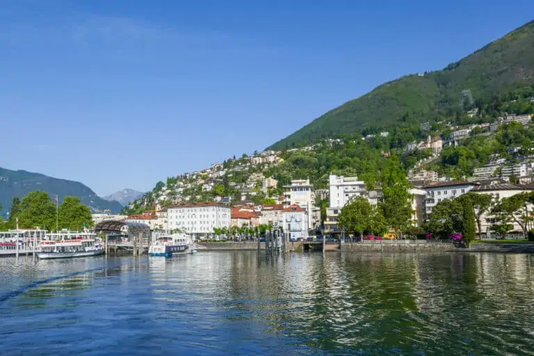
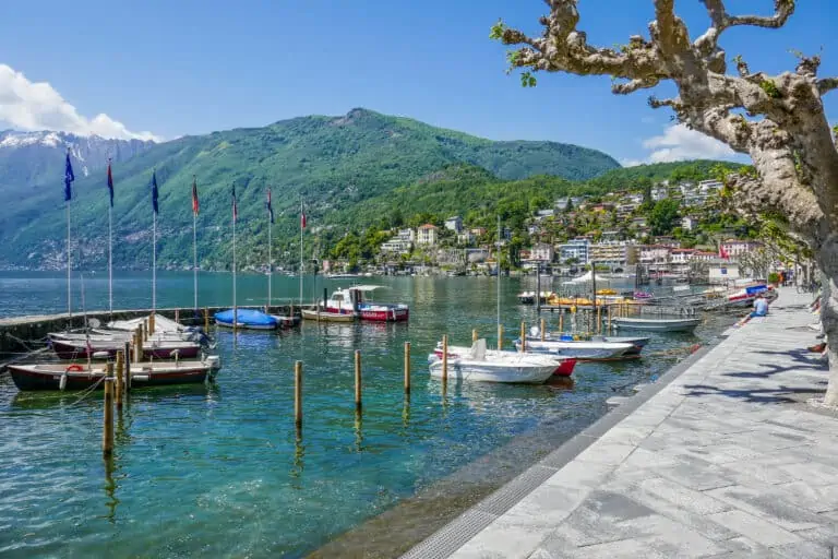
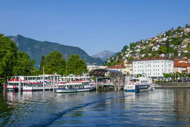
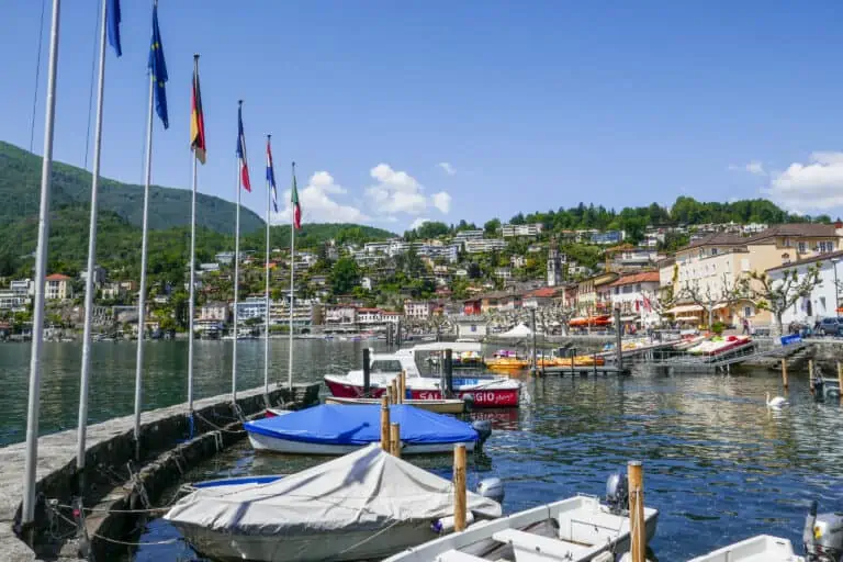
- You are now at the small park Giardini Jean Arp on Lake Maggiore. Follow the path along the lake, the marina and the Lake Maggiore boat docks for about 1 km.
- Turn left into the Via S. Vittore and then the Via Scazziga. You'll reach the train station after 200 m.
Map of our town hike in Locarno

Best months
This hike can be done all year. We think it's most attractive from spring to fall. The parks in Locarno and the surrounding hills look prettiest in these months.
Locarno is at low altitude and warm to Swiss standards, and if temperatures rise in July and August you may not like a city hike. But you can avoid the warmest time of the day by planning this walk in the early morning or late afternoon.
Locarno isn't a top destination for a winter stay. Snow isn't likely due to the low altitude. But if you're in the Ticino in winter and want to see Locarno, this hike is still a great introduction to the town.
Weather tips and forecast
How to dress
Other than solid shows you don't need specific gear. Just dress according to the forecasts.
Best weather for this hike
Dry or nearly dry weather is preferable. You'll have plenty of options to take shelter from rain showers during the first section in the town center of Locarno, but less so during the second section along the lake.
Forecasts for Locarno

Other activities near Locarno
One day Ticino
Town walk Ascona
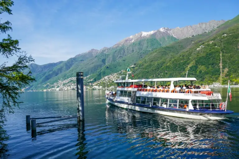
Boat Lake Maggiore
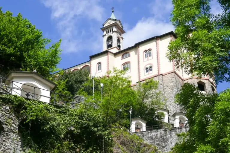
Madonna del Sasso