
Hiking in the Gastern Valley: the facts
- Hiking time: 3h30
- Difficulty: moderate
- Elevation: 1196 – 1495 m
- Distance: 11.4 km
- Terrain: meadows and forests in a high-altitude valley
- Region: Kander Valley (Bernese Oberland)
About the trail
The high Gastern Valley (Gasterntal) is located south-east of Kandersteg. It takes some time and effort to reach this secluded valley so there’s no mass tourism. It’s a magnificent area for hikers.
Directions and map
How to get to the Gastern Valley and back
The parking lot of Eggeschwand is close to the entrance to the Gastern Valley. There is a cable car station here, but you do not need it for this hike. You can walk from the railway station in Kandersteg to the parking lot in about half an hour.
The Gastern Valley is almost car-free. There is a limited bus service. Cars can access the narrow road during limited timeframes and after paying a road tax. We strongly recommend not driving here but rather enjoying the valley on foot.
How to walk in the valley and where to return
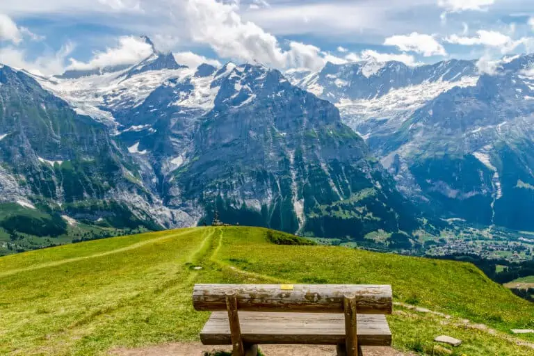
A steep path leads you from the parking lot into the valley. The desolated scenery with rocks and roaring streams suddenly changes place with a restful wide valley with meandering rivers and sandy plains. Impressive rock faces rise up from both sides of the valley.
The indicated duration and distance for this hike are averages. You will have to walk the same way back so it is up to you how far you walk into the valley. However, a path and a sandy road run parallel so some variation is possible.
The first part of the route mainly follows the river Kander. Then you will enter a forest. If you bother to walk further on you will see quite unusual, fierce rock faces.
Map of the hiking path in the Gastern Valley

Promotions 

Various multi-day packages for guided and self-guided trips to Switzerland. The offerings change regularly. Packages including surrounding countries are available too.
All about the Bernese Oberland

Bernese Oberland
Related blog posts
Hike Täsch-Zermatt
Hike First-Grosse Scheidegg