
7567 posts
Hi John-
Spend some time on the SwissTopo web site to understand the available products.
http://www.swisstopo.admin.ch /internet/swisstopo/en /home.html
Use “View on Swisstopo” to get detailed maps of all of Switzerland online..
Add an overlay for die Wanderwege for marked trails.
Paper maps are available in a variety of scales and with or without markings for the marked “Wanderwege.”
In a region as full of steep trails as that area, I personally like to have some form of topo map in my pocket. Could be a smartphone, but I like the expanse that shows on paper map. Those with marked trails are called “Wanderkarte” and are recently available in scales in addition to the standard 1:50,000.
You can buy every possible map at major bookstores in main towns. Convenience stores, train stations, etc.,sell them locally for the region.
Your price estimate is about right, but you’ll want more than one to cover the area.
Slowpoke
7567 posts
<<“Wengen Maennlichen,”>>
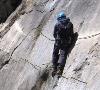
Not challenging if you like to climb about 1,000 meters up a clif side on a good trail….
Here are some hikes that may interest you:
http://www.jungfrau.ch/en/tou rism/destinations/klei ne-scheidegg/hiking-trails/
Also, check :
http://www.wanderland.ch/en/h iking-in-switzerland.html
If you find a hike there, you will get an altitude profile.
Slowpoke

606 posts
Hi JohnTravel,
In addition to the good suggestions above you will find a number of challenging hikes in the area (as well as some easier ones and other tips about the area) in a series of 3 PDFs at http://www.myswissalps.com/fo rum/topic/tips-about-wengen-and-the-jungfrau-region-by-kim
You really don’t need any maps but Photo Fritz and the stationery store in Wengen village (both on the small main street) have a very good selection if you change your mind.
Kim
279 posts
Hi,
A lot depends on what you mean by “Challenging”, and if the hike is a day trip, or overnight. If you are travelling without the family and walking alone, you don’t want to get too far off the beaten track, for safety reasons. A popular hike is up to the Gleckstein Hütte on the side of the Wetterhorn. It’s a bit exposed in places and rather steep, but worth the effort. If you’re going alone, ring ahead so the hut warden can keep an eye open for you. I know you said you wanted to get away from the crowds, but joining a guided group on a walk to the Konkordia Hütte would certainly be an experience. It’s a 2 day hike along the Aletsch Glacier. It’s on my bucket list.
In some ways, the Oberland is not the best place to get away from everybody – it’s tourist central.
As far as maps go, I always get the paper ones because they are so beautiful and they make great momentos of a fantastic trip. The 1:50,000 gives a great overview of the region. The Berner Oberland Blatt (Sheet) 5004 covers the area between Meiringen and Kandersteg. The 1:25,000 Jungfrau Region, Blatt 2520 only covers half the area, but in greater detail.
279 posts
I forgot to say, you can get the maps just about everywhere in the Oberland, especially sporting shops. On the back of each one is a map of Switzerland divided up into sections with the Blatt numbers soyo can work out what you need.
Cheers
Alan
7567 posts
Hi AlanPrice-
<<“As far as maps go, I always get the paper ones because they are so beautiful and they make great momentos of a fantastic trip”>>
Well said.
And, i find that planning walks is easier if i can spread out a map on a table and look at the route, the region, the public transport, all on the same scale.
When I first come into Zürich main station, I have list of the maps I need to buy….very few these days because I have a lot already ….and walk down the short flight of stairs from the main platform toward track 2 and into Barth Bücherei for maps.
Personally, in unfamiliar territory, I hike from 1:25,000 maps.
And, since the Wanderwege sometime climb and down hill for a scenic view, while I want to walk around the base to avoid the climb, the detail of a 1:25,000 lets me easily find paths or alternate ways, for example in the Emmental.
Slowpoke
279 posts
I can’t remember if I’m on my 3rd or 4th Berner Oberland 1:50. I keep telling myself I have to get an extra one to mount on the wall, but I always forget.
On a slightly different subject, I should have mentioned to JohnTravel about using a pocket altimeter as well as a compass, but there was no explanation of how far “Off the Beaten Track” was.
7567 posts
<<“about using a pocket altimeter as well as a compass, “>>
Good point – useful to locate your self on a topo map.
I used to have a Suunto wristwatch that did that. Nowadays, with bad knees, i don’t hike much where i need that precision.
Slowpoke


