Kandersteg-Frutigen: the facts

  • Hiking time: 5h00
  • Difficulty: moderate
  • Elevation: 780 – 1238 m
  • Distance: 16.8 km
  • Terrain: meadows and forests along the railway track in the Kander Valley
  • Region: Kander Valley (Bernese Oberland)

About this trail

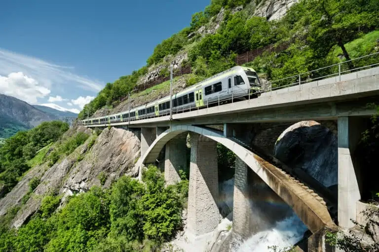
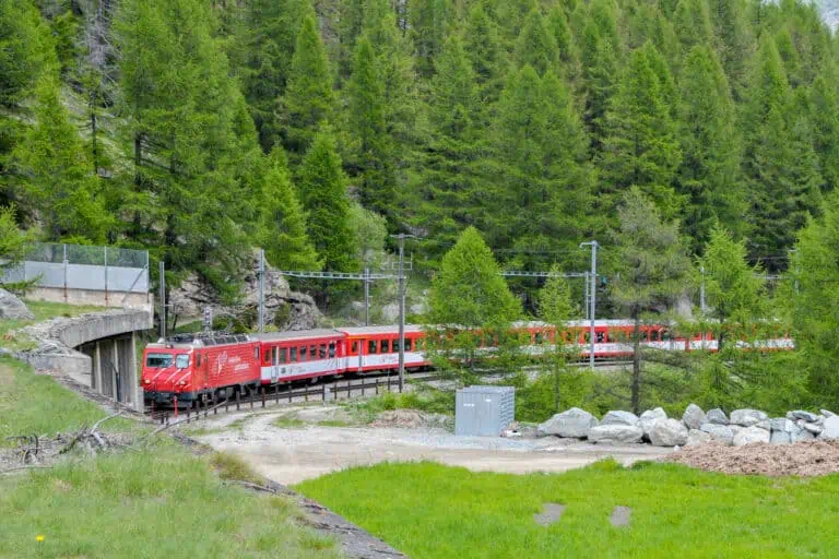
The Lötschberg Mountain Railway from Spiez to Brig is an impressive piece of railway engineering. You will walk along the northern section of this line, and learn about the railway from the many information boards along the way. The section near Mitholz is particularly interesting, because it contains two spiral loops, partly in tunnels. The loops allow the Lötschberger trains on this route to gradually gain height on their way to the Lötschberg Tunnel near Kandersteg.

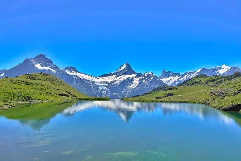
There are beautiful views of the Kander Valley as you cross the forests and meadows. The route can be shortened by two hours taking the bus to Mitholz and starting your walk from there.

Note that there is a trail along the southern section of the Lötschberg railway too.

Directions and map

How to get to Kandersteg and back from Frutigen

Kandersteg and Frutigen can be reached by regional trains from Spiez and Brig.

Hiking route

Follow the sign “Bahnwanderweg” from the rail station of Kandersteg.

Map of the Lötschberg Nordrampe hiking trail Kandersteg-Frutigen

Maps are available to members only
Check out all the benefits members have access to
Create a free account
Map

Promotions Copy link to clipboard

TourRadar
Swiss travel packages deals

Various multi-day packages for guided and self-guided trips to Switzerland. The offerings change regularly. Packages including surrounding countries are available too.

These promotions are offered by our trusted partners.
Find other promotions

About the Lötschberg trains and the Bernese Oberland Copy link to clipboard

RegioExpress Lötschberger between Lalden and Brig

Lötschberg Mountain Railway

The Lötschberger trains cross the Swiss Alps and connect Bern in the north to Brig in the south. It's an …
Rosenlaui valley towards Grindelwald, Wetterhorn and Eiger from Hasliberg

Bernese Oberland

The Bernese Oberland is a popular Swiss holiday region south-east of the city Bern. You'll find a very diverse landscape …

Other blog posts you may like Copy link to clipboard

Local train between Täsch and Zermatt

Hike Täsch-Zermatt

Walk along the railroad in the Matter Valley to the famous mountain resort Zermatt.
Bench with view of Schreckhorn and Grindelwald, between First and Grosse Scheidegg

Hike First-Grosse Scheidegg

Easy walk across alpine meadows with great views of the Jungfrau massif. You can continue by bus or on foot …
Reflection of Schreckhorn and Finsteraarhorn in Bachalpsee

Hike First-Bachsee

Popular, easy trail to a beautiful mountain lake with reflections of the Schreckhorn and other mountains above Grindelwald.

About MySwissAlps

We’re passionate tourists and locals. We share tips about how to plan a trip to Switzerland. MySwissAlps was founded in 2002.

Get a free account for a worry-free trip

  • Join our 10610 members and ask us questions in the forum
  • Access to member-only promotions
  • Detailed maps and weather forecasts

Planning your first Switzerland adventure?

Get a jump-start with Annika’s 20-minute e-mail course, “Switzerland for beginners”. Subscribe to our newsletter to unlock the course.

Annika
Page author: AnnikaSince early childhood I've been visiting Switzerland during my holidays and I just fell in love with the country. I spent many summers in the Bernese Oberland, which still feels like my second home, and then started to explore other areas. Traveling, hiking and photographing in the Swiss Alps are my absolute favorite activities.