InfoMySwissAlps.com includes display ads, non-commercial links, and commercial links to Stay22 and other trusted partners.

Lötschberg southern ramp hiking trail from Hohtenn to Lalden Copy link to clipboard

Impressive hiking route along the southern ramp of the Lötschberg Mountain Railway, with wide views across the Rhone Valley.

Train on the Bietschtal viaduct in the Rhone valley

The easy way to plan your Switzerland trip

➤ Let the experts handle the research and bookings for you. We design a unique, independent journey based on your wishes. Save time and avoid common mistakes. See how it works

Hohtenn-Lalden: the facts

  • Hiking time: 5h05
  • Difficulty: moderate
  • Elevation: 793 – 1076 m
  • Distance: 18.1 km
  • Terrain: trail along the railway through meadows, forests and rocky slopes
  • Region: Upper Rhone Valley in the Valais; the nearest larger town is Brig

About this trail

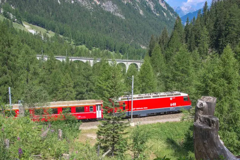
The Lötschberg Mountain Railway from Spiez to Brig is an impressive piece of railway engineering. The trail allows you to admire the viaducts and trains at this southern section of the railway, but also the rough landscape of this region. This dry area has a warm Southern European climate in summer. You may encounter salamanders here. The area has an ancient open irrigation system consisting of narrow channels, which is still in use today.

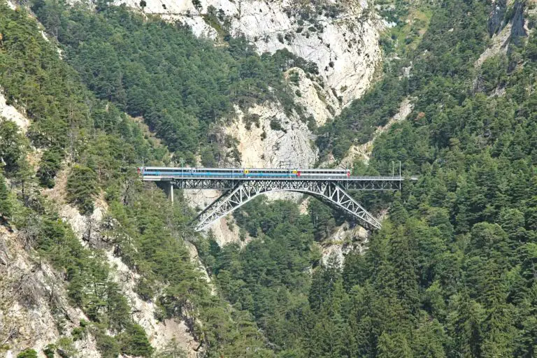
You will pass the beautiful Luogelkinn viaduct at the beginning of the route. About halfway between Hohtenn and Ausserberg, you will walk through a pedestrian tunnel that has been used by small work trains when the railroad was built. You will reach the Bietschtal viaduct right after the tunnel. If you want to take a picture here: a good shot of the entire viaduct can be taken about 500 m (1,600 ft) further down the trail.

The majority of the route consists of easy paths. The trail is a bit more difficult as you cross the Baltschiederbach, a stream between Ausserberg and Eggerberg.

The route can easily be shortened by taking the train from Ausserberg or Eggerberg instead of Lalden. Also you can extend the route by 2h40 by continuing to the town of Brig, down in the valley.

Note that there is a trail along the northern section of the Lötschberg train line too.

Directions and map

How to get to Hohtenn and from Lalden

The easiest way to reach the railway station in Hohtenn is by the regional Lötschberger train from Spiez or Brig. These trains stop in Lalden as well.

The hiking route

Follow the signs ‘Lötschberger Südrampe’. Also, you can pay attention to the signs pointing to the next village: Ausserberg, Eggerberg and Lalden.

Map of the Lötschberg Südrampe trail from Hohtenn to lalden

Maps are available to members only
Check out all the benefits members have access to
Create a free account
Map
About the Lötschberg train route and the Valais Copy link to clipboard
View over the western part of the Rhone Valley from the Lötschberger train between Goppenstein and Ausserberg.

Lötschberg Mountain Railway

The Lötschberger trains cross the Swiss Alps and connect Bern in the north to Brig in the south. It's an …
Aletsch Glacier seen from Moosfluh in September

Valais

The Valais is a spectacular region in southern Switzerland, home to the Aletsch Glacier and the Matterhorn. There are high …
Other blog articles you may like Copy link to clipboard
The castle of Oberhofen, surrounded by a wall and pine trees.

Free with the Swiss Travel Pass in the Bernese Oberland

The Swiss Travel Pass includes a lot of free panoramic trips in the Bernese Oberland.
Telescope at Gornergrat viewpoint.

Gornergrat, Matterhorn Glacier Paradise, Sunnegga-Rothorn

Gornergrat, Matterhorn Glacier Paradise and Sunnegga-Rothorn: 3 amazing mountain excursions from Zermatt. How to choose, or how to combine these …
Local train between Täsch and Zermatt

Hike Täsch-Zermatt

Walk along the railroad in the Matter Valley to the famous mountain resort Zermatt.
Bench with view of Schreckhorn and Grindelwald, between First and Grosse Scheidegg

Hike First-Grosse Scheidegg

Easy walk across alpine meadows with great views of the Jungfrau massif. You can continue by bus or on foot …
Glacier Express train in Val Bever

Glacier Express reservations
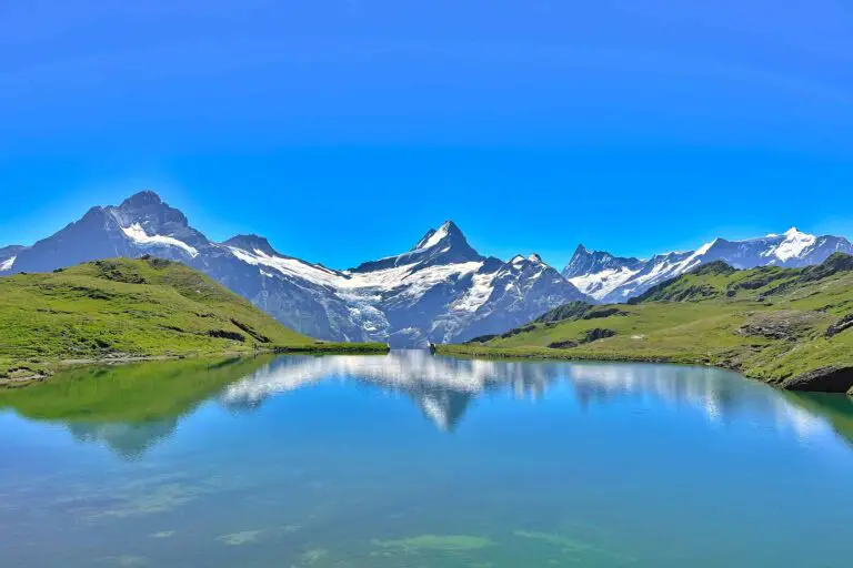
This is how to get your seat reservations for the popular Glacier Express in 2026: my 7 insider tips.
Reflection of Schreckhorn and Finsteraarhorn in Bachalpsee

Hike First-Bachsee

Popular, easy trail to a beautiful mountain lake with reflections of the Schreckhorn and other mountains above Grindelwald.
Church in Kander valley near Kandersteg

Hike Kandersteg-Frutigen

Enjoy the Kander Valley and learn about the Lötschberg Mountain Railway at the same time.
Rosenlaui valley towards Grindelwald, Wetterhorn and Eiger from Hasliberg

Hike Grosse Scheidegg-Meiringen

Admire the great scenery during this hike between the valleys of Grindelwald and Meiringen. It starts just above the tree …
Rhätische Bahn train between Preda and Bergün

Hike Preda-Bergün

Watch the famous red trains of the Albula train line and the amazing landscape.
Rock formation at Schynige Platte, Bernese Oberland

Hike Schynige Platte

Beautiful circular panorama trail with alpine flowers and views of the Jungfrau.

About MySwissAlps

We’re passionate tourists and locals. We share tips about how to plan a trip to Switzerland. MySwissAlps was founded in 2002.

Get a free account for a worry-free trip

  • Join our 9400 members and ask us questions in the forum
  • Detailed maps and weather forecasts

Planning your first Switzerland adventure?

Get a jump-start with Annika’s 20-minute e-mail course, “Switzerland for beginners”. Subscribe to our newsletter to unlock the course.

Annika
Page author: AnnikaSince early childhood I've been visiting Switzerland during my holidays and I just fell in love with the country. I spent many summers in the Bernese Oberland, which still feels like my second home, and then started to explore other areas. Traveling, hiking and photographing in the Swiss Alps are my absolute favorite activities.