 Min. time required: 2:00
 Season: all year
 Recommended season: all year
 Max. altitude: 483 m (1585 ft)
About this Lucerne city walk 
This self-guided 8.2-km city walk in Lucerne makes sure you won't miss anything: the Chapel Bridge, City Wall, Gütsch Castle, various churches and museums, the historical Old Town, the Lion Monument, the lake, and even the less touristy Neustadt are all included.
Without breaks, you can complete the route in 2 hours. But we recommend allocating a minimum of 3 hours to allow for a leisurely pace and some photography along the way.
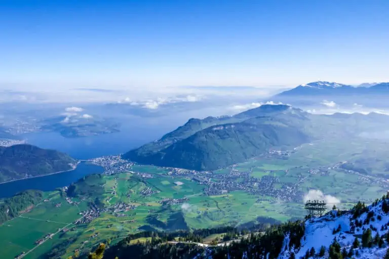
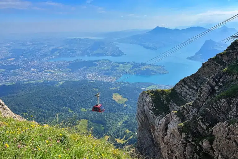
You can spend a full day in Lucerne if you also make a boat trip, have lunch, do some souvenir shopping, or visit one or more museums, such as the Swiss Museum of Transport.
Prices for this city walk
The walk: free
This Lucerne hiking tour is completely free.
Tickets to travel to Lucerne
You may need to travel to Lucerne first. We recommend doing so by train.
If you'll be staying in Switzerland for a while you'll probably use a rail pass to save money. Rail passes can allow discounted or free traveling to Lucerne. If you don't have a rail pass, you'll have to buy normal full-fare tickets
Find other Lucerne city tours
There are many other (partially) guided tours in Lucerne available.

Offered by Viator: www.viator.com
- Easy, online, free cancellation in most cases
- Lowest Price Guarantee: Viator will refund the difference if you find a better price.
- Extra Support: if you buy here, MySwissAlps can also assist if you have questions about your order.

Offered by Viator: www.viator.com
- Easy, online, free cancellation in most cases
- Lowest Price Guarantee: Viator will refund the difference if you find a better price.
- Extra Support: if you buy here, MySwissAlps can also assist if you have questions about your order.

Offered by Viator: www.viator.com
- Easy, online, free cancellation in most cases
- Lowest Price Guarantee: Viator will refund the difference if you find a better price.
- Extra Support: if you buy here, MySwissAlps can also assist if you have questions about your order.
Promotions
There are currently no promotions available.
City hike directions and map
How to get to Lucerne
Lucerne can best be reached by train. This walking tour starts at the main train station. Find details about reaching Lucerne here:
How to travel back at the end of the tour
The route ends at the Swiss Museum of Transport on Lake Lucerne. You can take a boat, bus or train to travel back to the main train station or another destination. Find details about getting to and from the museum here:
Hiking route description
You can find the route on the map on this page. Please find the detailed street-by-street directions below:
Section 1: from the train station via Neustadt to the Chapel Bridge
- Turn right after leaving the main hall of the train station, and walk to the building at the lakefront. This is the convention center (Luzern KKL). The square in front of it is a good spot to enjoy the view of the lake and the town center across the lake.
- Walk back to the station, pass it, and turn left, then right into the Frankenstrasse. You're now entering the city quarter called Neustadt. Everyday life in Lucerne can be observed here better than in the touristy city center, which is of course included in the route as well.
- Enter the small park (Vögeligärtli) on your left, with a church at the opposite side (the Lukaskirche).
Pass the church and enter the Sempacherstrasse. Turn right into the Habsburgerstrasse, and right again into the Hirschmattstrasse. - Turn left into the Pilatusstrasse. You'll reach a big junction, where you need to turn right into the Obergrundstrasse. Continue straight on into the Franziskanerplatz.
- You'll see the Franciscan Church (Franziskanerkirche) to your right.
- At the end of the street, turn left and immediately right into the Burgerstrasse.
- Turn right once you have reached the river Reuss, immediately right again into the narrow Münzgasse.
- Turn left and again left into the Krongasse. Once you reach the bridge (Reussbrücke), do not cross it but turn right before the bridge. After 50 m, you'll find the Jesuit Church (Jesuitenkirche) to your right.
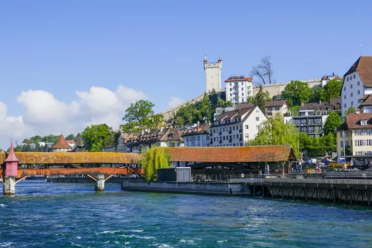
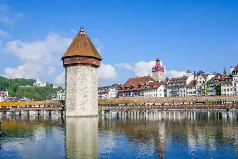
- Keep walking, while the river is still on your left. The second bridge is the famous Chapel Bridge (Kapellbrücke) with its Water Tower (Wasserturm).
Section 2: from the Chapel Bridge across the Old Town to Gütsch Castle
- Cross the Chapel Bridge, which dates back to the 14th century.
- Turn left and walk along the river until you reach the next bridge. Turn right here, and take the steps up to the Kornmarkt.
- Turn right into the Furrengasse. You'll reach a small square with St. Peter's Chapel (Peterskapelle).
Pass the chapel on its left and follow the Kapellplatz until you see the wide bridge (Seebrücke) on your right. - Turn left, and left again into the Ledergasse. You'll reach a small square (Stiefelplatz) after about 60 m. Cross the square and proceed into the Gerbergasse.
- You'll now reach another small square: the Sternenplatz. Cross it and enter the Theilinggasse. Then turn left into the Weggisgasse.
- Follow the Weggisgasse until you reach a small square again: the Hirschenplatz. Cross it to enter a bigger square: the Weinmarkt.
- Walk straight ahead and turn right at the end of the street, then immediately left. You've reached the Mühlenplatz, which is another square.
- Cross the river Reuss via the Spreuerbrücke. Then enter the busy Baselstrasse. Walk on its left since that's where you'll find the funicular stop.
- You can optionally ride up to Gütsch Castle to enjoy the view of the city and have a drink or lunch. The castle is a hotel and restaurant nowadays.
Section 3: from Gütsch Castle via the City Wall and the lake to the Museum of Transport
- Take the funicular down from Gütsch Castle and turn right into the Baselstrasse.
- Quickly turn left into the Gütschstrasse and cross the river. You'll see the first tower of the historical City Wall to your right.
- Turn right and enter the footpath to the left of the wall.
- The 6th tower is the Zytturm. If it is accessible, you can enter it to walk on the wall to the next tower (Schirmerturm) and go down there.
- After the Schirmerturm, walk down across the small park until you reach the Museggstrasse. Turn left and follow this street until you can turn left to reach the busy square called Löwenplatz. The Glacier Garden museum, Alpineum, Bourbaki Panorama, and Lion Monument can all be found in this area.
- Cross the square and enter the Löwengartenstrasse. Enter the Denkmalstrasse to reach the Glacier Garden museum.
- Turn around and walk back into the Denkmalstrasse to reach the famous Lion Monument (Löwendenkmal) on your left.
- Walk straight on and enter the Löwenstrasse. Then turn left into the Dreilindenstrasse.
- Turn right into the St. Leodegarstrasse.
- After about 60 m, turn right into the narrow St. Leodegarstrasse/Stiftstrasse. You'll find the beautiful Church of St. Leodegar (Hofkirche St. Leodegar) on your left.
- Turn right to go down the stairs and then left to reach Lake Lucerne.
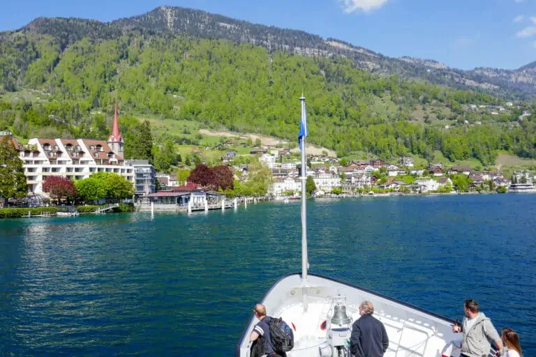
- At the lake, turn left and keep walking along the water until you reach the Swiss Museum of Transport, which is where this route ends.
Map with the Lucerne walking route

Best months for a Lucerne walk
This hike can be done all year round. It's suitable in any season. Examples:
- Lucerne looks very vibrant in summer and spring. And even though it can get hot in Lucerne during summer, you'll always have the nearby lake to cool down during a boat tour.
- This walk is perfect in low-season months like March and November, when some of the mountain routes in the Lake Lucerne region aren't operational.
- If you like the holiday season, combine this walk with one of the Lucerne Christmas markets in late November and December.
Weather and forecast
How to dress
Other than solid shows you don't need specific gear. Just dress according to the forecasts.
Weather required for this hike
As long as it's (nearly) dry you can explore Lucerne on foot. There are plenty of restaurants and cafes to take a break if a rain shower comes along. This hiking tour is an excellent bad-weather alternative to mountain trips in the Lake Lucerne region.
5-day forecasts for Lucerne
Info about activities to combine this walk with
Boat Lake Lucerne
Pilatus
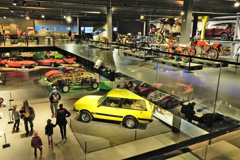
Swiss Museum of Transport
About Lucerne and its lake
Lucerne