InfoMySwissAlps.com includes display ads, non-commercial links, and commercial links to Stay22 and other trusted partners.

Walking from Sillerenbühl to Bergläger near Adelboden, Bernese Oberland Copy link to clipboard

Varying route across the fresh green hills of Adelboden, surrounded by high mountain peaks.

Purple chives in the Hahnenmoospass hiking area

The easiest way to plan for Switzerland

➤ No need to spend hours on research. We use our local expertise to plan your independent trip exactly as you want it. Professional and easy. See how it works

Sillerenbühl-Hahnenmoospass-Bergläger: the facts

  • Hiking time: 2h45
  • Difficulty: moderate
  • Elevation: 1481 – 2084 m
  • Distance: 9.9 km
  • Terrain: meadows, forests
  • Region: Engstligen Valley (Bernese Oberland)

About this trail

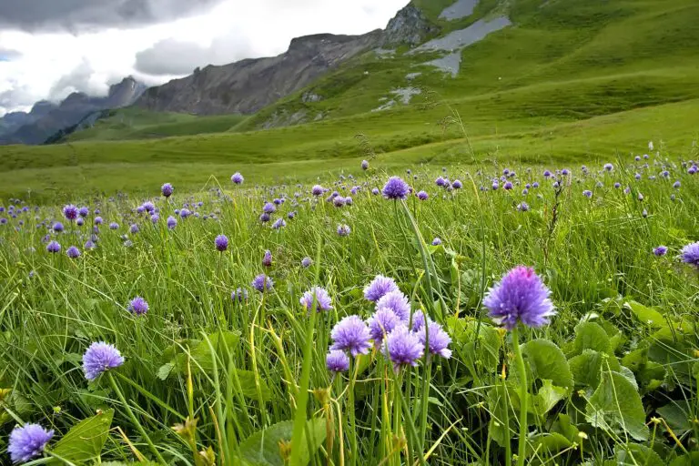
The first part of this route, between Sillerenbühl and the Hahnenmoos Pass in the Vogellisiberg area near Adelboden, is called the “Blumenweg” (“flower trail”): the names of the many flowers along the path are indicated at signs.

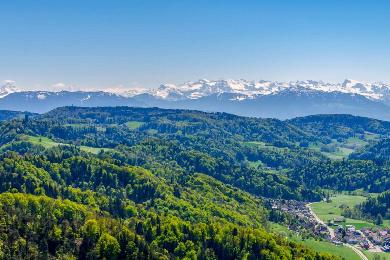
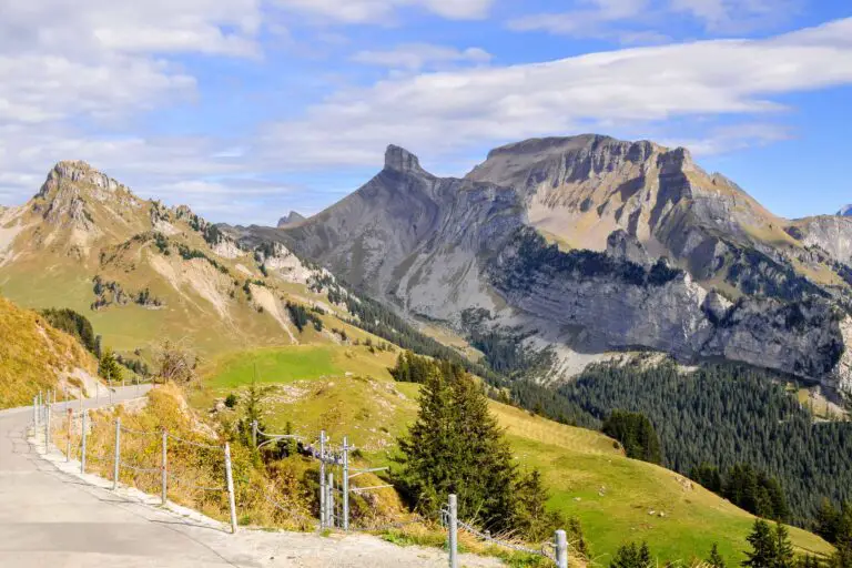
You will have views of a fresh green landscape, surrounded by high peaks such as the Rinderhorn, Altels, Wildstrubel, Glacier de la Plaine Morte, Weisshorn, and Albristhorn. At the Hahnenmoos pass, you can also see some mountains belonging to the canton of Valais.

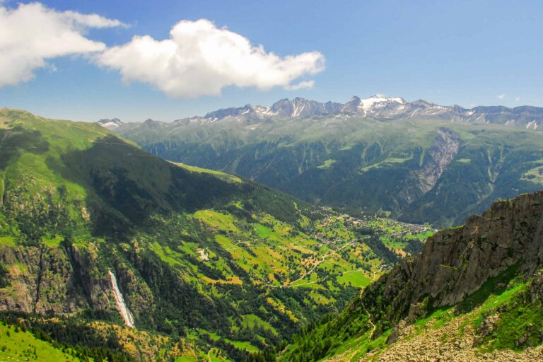
You will then walk along the base of the Regenboldshorn, heading for the high valley of Lurnig, where your sight will reach as far as the Niederhorn across the Thunersee, situated about 35 km (22 miles) away.

The route continues along the 700 m (2,300 ft) high rock walls of the Rotstock. After Lurnig, you will be able to look down on the waterfall of the Bütschibach. Then you will cross the tree line, and through conifer forests and meadows, you’ll reach the ending point of Bergläger.

Directions and map

How to get to Sillerenbühl

From Adelboden, take the gondola up to Sillerenbühl. Adelboden can be reached by car or by bus from the rail station in Frutigen. There is a parking lot at the mid-station of Oey.

How to get back from Bergläger

From Bergläger, take the gondola back to Oey/Adelboden.

The hiking route

  • Follow the signs to the Hahnenmoos Pass. From there, head for the Regenboldshorn. Further on, follow the signs pointing to Bütschi.
  • When you have arrived at Luegli, take the shortest road to Bütschi through the path on the right.
  • From Bütschi, start heading for Bergläger. Follow the signs to Adelboden (you will have to cross the road) until you reach the gondola station of Bergläger.

Map of the flower trail Sillerenbühl-Bergläger

Maps are available to members only
Check out all the benefits members have access to
Create a free account
Map
Our Bernese Oberland info and tips Copy link to clipboard
The town of Interlaken and the Bernese Alps seen from Harder Kulm.

Bernese Oberland

The Bernese Oberland is a popular Swiss holiday region south-east of the city Bern. You'll find a very diverse landscape …
Related blog articles Copy link to clipboard
The castle of Oberhofen, surrounded by a wall and pine trees.

Free with the Swiss Travel Pass in the Bernese Oberland

The Swiss Travel Pass includes a lot of free panoramic trips in the Bernese Oberland.
Local train between Täsch and Zermatt

Hike Täsch-Zermatt

Walk along the railroad in the Matter Valley to the famous mountain resort Zermatt.
Bench with view of Schreckhorn and Grindelwald, between First and Grosse Scheidegg

Hike First-Grosse Scheidegg

Easy walk across alpine meadows with great views of the Jungfrau massif. You can continue by bus or on foot …
Reflection of Schreckhorn and Finsteraarhorn in Bachalpsee

Hike First-Bachsee

Popular, easy trail to a beautiful mountain lake with reflections of the Schreckhorn and other mountains above Grindelwald.
Church in Kander valley near Kandersteg

Hike Kandersteg-Frutigen

Enjoy the Kander Valley and learn about the Lötschberg Mountain Railway at the same time.
Rosenlaui valley towards Grindelwald, Wetterhorn and Eiger from Hasliberg

Hike Grosse Scheidegg-Meiringen

Admire the great scenery during this hike between the valleys of Grindelwald and Meiringen. It starts just above the tree …
Rhätische Bahn train between Preda and Bergün

Hike Preda-Bergün

Watch the famous red trains of the Albula train line and the amazing landscape.
Rock formation at Schynige Platte, Bernese Oberland

Hike Schynige Platte

Beautiful circular panorama trail with alpine flowers and views of the Jungfrau.
Panorama views over the Upper Rhone valley from Fiescheralp

Hike Bettmerhorn-Märjelensee-Fiescheralp

Extraordinary trail along the Aletsch Glacier with many beautiful views of the Bernese and Valaisian Alps.
View to Felsenegg from Uetliberg, Zurich

Hike Uetliberg-Felsenegg

Get a bird's eye view of Zurich and Lake Zurich on the lovely walk from Uto Kulm (the top of …

About MySwissAlps

We’re Arno & Annika: passionate, frequent Switzerland travelers. We help you plan your trip, or we plan it for you. MySwissAlps was founded in 2002.

Want us to plan your trip?

The easiest way to plan your trip is to let us handle the itinerary design and bookings for you. We design a unique, independent journey based on your wishes.

Just need some help planning your trip?

Let us help you personally, or post your questions to our forum.

Annika
Page author: AnnikaSince early childhood I've been visiting Switzerland during my holidays and I just fell in love with the country. I spent many summers in the Bernese Oberland, which still feels like my second home, and then started to explore other areas. Traveling, hiking and photographing in the Swiss Alps are my absolute favorite activities.