
7567 posts
Mike-
Once you get above Wengen or Grindelwald, you are going to have to spend some money on transport, unless you like 800-1000 meter climbs up to 2000 or more meters before you start the point-to- point hike. The transportation up there is privately owned, and expensive to keep running.
http://www.myswissalps.com/be rneseoberland
and
http://www.myswissalps.com/ju ngfrauregion
This give schedules:
http://www.myswissalps.com/ti metable
As you focus in on various routes, come back and explore costs further. There may be a benefit to getting some form of reduced fare pass, as a supplement to your Eurail pass.I don’t know what your Eurail pass covers in the Jungfrau Region.
Arno and Annika, the forum moderators, are the resource for that information.
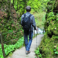
A trivially easy hike, but with some of the best views in Switzerland, runs from Männlichen to Kleine Scheidegg. It far outclasses the Eiger trail, in my view. Much better in the stated direction, going toward KS and the Eiger.
Take a look at these links.
http://www.myswissalps.com/hi king
http://www.myswissalps.com/fo rum/topic/tips-about-wengen-and-the-jungfrau-region-by-kim
You may want to consider Schynige Platte to First. Not an easy hike, but very rewarding
This following map is extremely powerful, but it takes work to learn all the options. One is to display hiking trails.
Home page and map links as follows –
http://www.swisstopo.admin.ch /internet/swisstopo/en /home.html
map.geo.admin.ch/?topic=swisstopo&lang=e n&bgLayer=ch.swisstopo .pixelkarte-farbe&layers=ch.swisst opo.zeitreihen,ch.bfs. gebaeude_wohnungs_regi ster,ch.bafu.wrz-wildruhezonen_portal,c h.swisstopo.swisstlm3d -wanderwege,ch.swisstop o.swissalti3d-reliefschattierung&lay ers_visibility=false,f alse,false,true,false& layers_timestamp=18641 231,,,,&X=164600.00&Y= 639960.00&zoom=5
and
map.geo.admin.ch/?topic=swisstopo&lang=e n&bgLayer=ch.swisstopo .pixelkarte-farbe&layers=ch.swisst opo.zeitreihen,ch.bfs. gebaeude_wohnungs_regi ster,ch.bafu.wrz-wildruhezonen_portal,c h.swisstopo.swisstlm3d -wanderwege,ch.swisstop o.swissalti3d-reliefschattierung&lay ers_visibility=false,f alse,false,true,false& layers_timestamp=18641 231,,,,&X=168160.00&Y= 640500.00&zoom=6
And, info about “die Wanderkarte,” topo paper maps with marked trails (die Wanderwege).
http://www.swisstopo.admin.ch /internet/swisstopo/en /home/products/maps/na tional/25.html
Have fun planning. There is a lot of information available.
Slowpoke

7135 posts
Hi Mike, welcome to MySwissAlps!
South from Interlaken, Eurail passes provide a 25% discount. You can check details at myswissalps.com/eurail globalpass/validity. So it won’t be easy to make hikes without additional payment for public transportation. Regular prices can be found by following the links at our attraction pages, like our Jungfraujoch and Schilthorn pages. Further price lists are at the Schilthorn and Jungfrau railways websites.
7567 posts
15485 posts
Did the responses help you out Mike?

72625 posts
Yeah they answered my original question, just wasn’t aware my Eurail pass does not work south of Interlaken, so now its more finding the best trails that are affordable for me.
15485 posts
Hi Mike,
The map Annika referred to helps you to find free routes (e.g. along the lakes). Apart from that, your hotel will give you a Visitors Card (a link can be found here) that will get you to Wilderswil for free, for example. From there you can walk into the Lauterbrunnen valley for as far as you want, then take the train back. Again you would only need a ticket back to Wilderswil, and with the 25% discount of your Eurail Pass included it’s probably less than CHF 5. This is a valley walk. If you go up into the mountains it’s more expensive.
Did you find the hotel suggestions? These pages will be helpful:
For detailed tips you can ask in the accommodation forum.
7567 posts
<<“Where you take the gondola up to Grütschalp and then follow a path to Murren, and then can access the Trummelbach Falls. All sites I have visited never state the price for these gondolas, for example the Grütschalp, is it free, if not where do I check for prices?”>>
Mike – it ain’t totally free, but you named a part of the region that is substantially accessed by public transport, which tends to be well dicounted, rather than by excursion railways ( privately owned and not discounted much if at all).
The time table gives you costs…the first number is based on the assumption that you have “half-fare” card. You have to give it a sample itinerary to work on.
http://www.myswissalps.com/ti metable
Dig in a little further – lay out an actual trip and get e cost. then you go from a yes/no free/ expensive decision to working with a real number for the costs. I tmay fit your budget. if not, you might trade of something else.
The trip to price is –
Intelaken Ost to Lauterbrunnen to Mürren and return, by way of the two different route choices between Lauterbrunnen and Mürren..
If you cannot figure out how to do that, or how to walk parts of it, get back and I’ll give more detail.
Sorry that you did not understand the the Eurrail pass does not cover everything.
Have you bought it yet? If not, you might look first at your total planned itunerary, then see if the pass covers it.
Slowpoke.


