 Min. time required: 2:00
 Season: all year
 Recommended season: early April to late October
 Max. altitude: 3454 m (11332 ft)
Tickets to mountains with Aletsch Glacier views 

Offered by GetYourGuide: www.getyourguide.com
- Easy, online, free cancellation in most cases
- Best Price Matching: GetYourGuide will pay the difference if you find a lower price.
- Extra Support: if you buy here, MySwissAlps can also assist if you have questions about your order.

Offered by GetYourGuide: www.getyourguide.com
- Easy, online, free cancellation in most cases
- Best Price Matching: GetYourGuide will pay the difference if you find a lower price.
- Extra Support: if you buy here, MySwissAlps can also assist if you have questions about your order.
Offered by MySwissAlps: www.myswissalps.com
- Offer from one of our best partners.
- Extra Support: MySwissAlps can assist if you have questions about your order.
How to reach the Aletsch Glacier
Getting to the Aletsch Glacier: summary
- You'll have panoramic glacier views from several mountaintops in the Valais and the Bernese Oberland, as explained below. These viewpoints can be visited by public transport and cable cars.
- You can get closest to the glacier by hiking. Find suggestions below.
- You can't reach the glacier by car.
Bettmerhorn, Eggishorn and Jungfraujoch
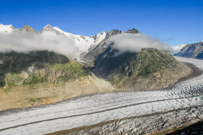
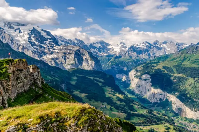
The easiest way to get panoramic views of the glacier is by visiting one of the mountains in the Valais. The tops we recommend are the Bettmerhorn and Eggishorn. Both can be reached by cable cars from the Rhone Valley, east of Brig.
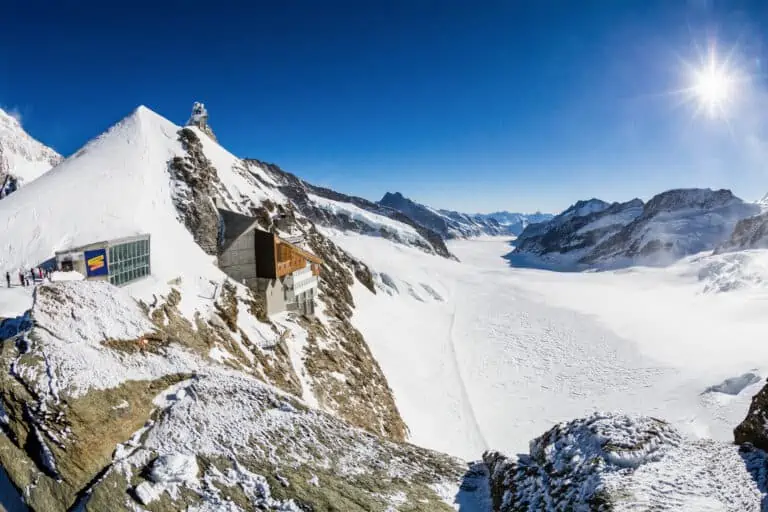
The glacier origins at the Konkordiaplatz can well be seen from Jungfraujoch in the Bernese Oberland. You can't "look around the corner" and see the full length of the glacier here. But the views of the massive ice mass at the Konkordiaplatz are no less impressive.
Map of the Aletsch Glacier area

Opening dates
Jungfraujoch can be reached year-round, but the Bettmerhorn and Eggishorn have seasonal breaks. Please find details below:
When to see the Aletsch Glacier
The glacier can be seen all year from Jungfraujoch, and during large parts of winter and summer from Bettmerhorn and Eggishorn.
Winter isn't the best time, as the mountain area will be covered in snow and you won't be able to clearly distinguish the glacier. That's why we recommend visiting the glacier in early April to late October.
These are the pros of each season:
- April, May, June, and October are the months in which the glacier looks prettiest to us. In spring, there's usually still snow left on the surrounding mountain peaks. In October, new snow may fall when the temperatures drop. These months are also low season, so viewpoints will be less busy than in July and August.
- July and August are high season. All vantage points for the Aletsch Glacier can be reached, and nearly all hiking trails will be accessible, even those at high altitudes.
- In September, there are fewer tourists. The air is overall less moist than in July and August, which makes for crisp views of the glacier. The downside is that there's usually not much snow left and that the area around the glacier can look quite rocky and bare.
Weather in the Aletsch area
The Aletsch Glacier is right within the Swiss Alps. This means that weather is unpredictable and changeable.
But overall, you can expect temperatures around freezing point near the glacier in the coldest months of January and February. Temperatures can range anywhere from 10°C to 25°C in summer. The exact temperature depends very much on the location from which you're seeing the glacier: it will be much colder at the Jungfraujoch than in the Aletsch forest down near the glacier tongue.
Also, the Bernese Oberland on the northern side of the Alps is usually a bit cooler and moister than the Valais on the southern side.
Please find further weather details here:
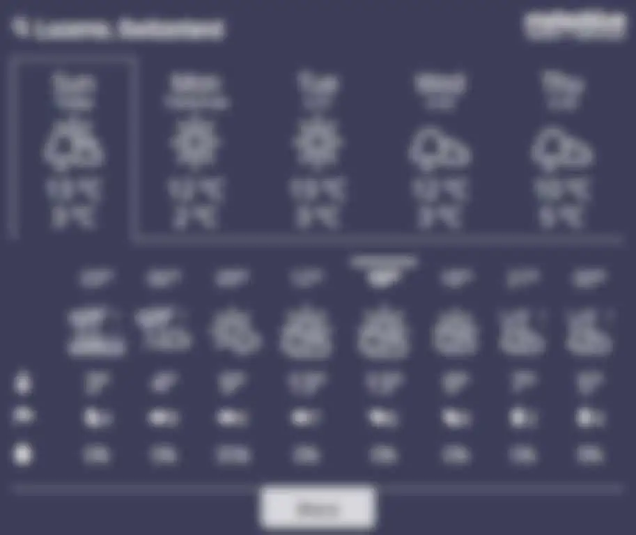
5-day forecast for the Aletsch area
Below is a short-term forecast for Bettmerhorn, one of the Aletsch Glacier viewpoints. Always check the local forecast of your specific destinations: there can be regional and even local differences.
Hike Riederalp-Aletschwald-Bettmeralp
About this trail
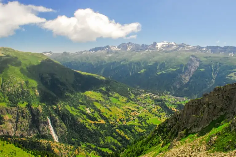
The Aletsch Forest (Aletschwald) is located along the moraines of the Aletsch Glacier, which was once much longer and reached all the way to the Rhone Valley. You will have a magnificent view of the glacier as you stand in the beautiful forest. You will pass two small lakes as you descend to Bettmeralp.
How to get there and back
The cable car to Riederalp departs from the train station in Mörel.
From Bettmeralp, take the cable car down to the rail station Betten. Further details can be found on the Bettmerhorn page.
The hiking route
From Riederalp, follow the signs up to the hotel/restaurant at Riederfurka. Now enter the forest via the “Unterer Aletschweg”.
Keep walking towards the glacier, but eventually turn around until the point where you can go up to Blausee/Moosfluh. Walk along the Blausee (blue lake) and the larger lake called Bettmersee. From there, go right to Bettmeralp and follow the signs to the cable car station at the other end of the village.
Hike Bettmerhorn-Märjelensee-Fiescheralp
This trail starts at Bettmerhorn. The first section runs above, and parallel to, the Aletsch Glacier. You’ll have a grand glacier panorama before bending south toward Fiescheralp.
Please find a details description of this hike in our blog.
Other hikes in the Aletsch area
There are many more beautiful hiking trails near the glacier. Find options here.
More about the Aletsch Glacier
What is the Aletsch Glacier?
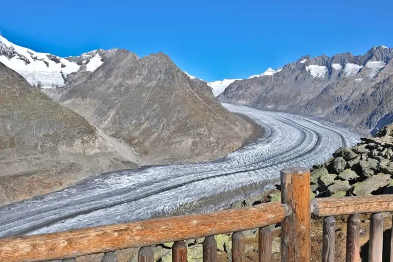
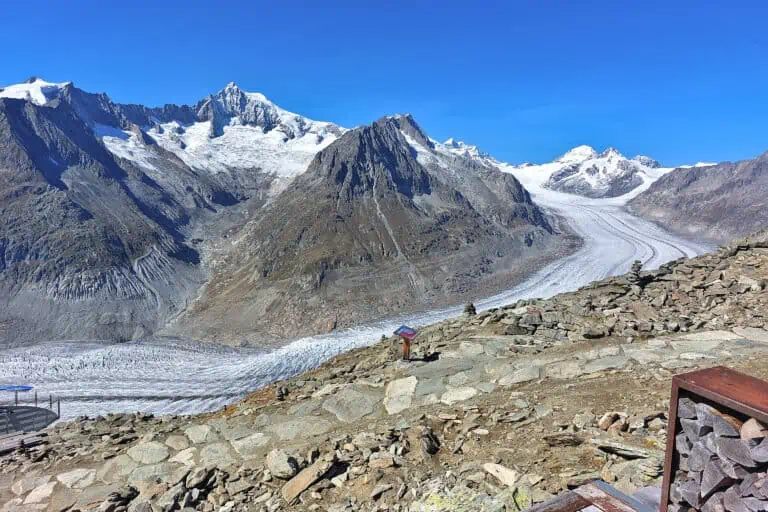
The Grosser Aletschgletscher, meaning “Large Aletsch Glacier”, is the largest glacier in the Alps. It’s in the mountains between the Bernese Oberland in northern Switzerland and the Valais in southern Switzerland. This area is so special that it’s a UNESCO World Heritage site, called “Swiss Alps Jungfrau-Aletsch”.
The glacier is about 20 km (12,4 miles) long and 1 km (3300 ft) wide on average. It originates from the Konkordiaplatz, which can be viewed from the Jungfraujoch. The weight of the fresh snow in that area causes snow to be pressed to ice. This is a year-round process. The ice is 800 m (2625 ft) thick here.
The name “Aletsch Arena” refers to the area just south of the glacier: above the Rhone Valley in the canton of Valais. Many cable cars, ski lifts, hiking trails and ski routes can be found in this region.
How does climate change affect the glacier?
Global warming is causing the glacier to shrink, and at an exceeding pace. Its surface is about 79 km2, which is less than in previous decades. At the moment, the glacier retreats by about 50 m per year in length. It also gets thinner and quickly shrinks at the edges.
If this process continues and accelerates as expected, there will only be a small part of the glacier left by the end of this century. In worst-case scenarios, it may even have disappeared. The glacier is still impressive, but it’s sad to see how CO2 emission caused by humanity is tearing down this natural landmark.
Other websites of interest
- www.aletscharena.ch: hiking near the Aletsch Glacier
Itineraries that include views of the Aletsch Glacier
Best of the Alps
Our blog posts about this area
Hike Bettmerhorn-Märjelensee-Fiescheralp
Our guides about the glacier activities
Bettmerhorn
Eggishorn