First-Schynige Platte: the facts
- Hiking time: 6h00
- Difficulty: difficult
- Elevation: 1924 – 2613 m
- Distance: 16.0 km
- Terrain: high-alpine rocky areas and mountain meadows
- Region: Jungfrau Region (Bernese Oberland)
About this trail
The route from First to Schynige Platte (or the other way around) is quite demanding. It’s beautiful though, and probably the most popular trail in the region.
It is advisable to start early in the day, since this is a long hike and you may want to take some time to enjoy the views. Make sure that your hiking gear is good and durable, as you have to cross various rocky paths and perhaps snow fields. Solid shoes, a hiking stick, experience and solid preparation are essential. So are good weather forecasts.
Optionally you can take two days to complete this hike, by spending the night in the hotel at the Faulhorn or the Männdlenen hut a bit further on.
From First to Schynige Platte or the other way around: what’s better?
The hike can be made in both directions. We prefer First-Schynige Platte, because you’ll first have the somewhat steep climb up the Faulhorn, and then a long and mostly gentle descent toward Schynige Platte. So the most demanding part of the route is finished at the beginning.
Others prefer starting at Schynige Platte. You’ll have a long and gradual ascent up to the Faulhorn, with a steeper descent from Faulhorn to the Bachsee and Grindelwald-First at the end. An advantage of this direction is that getting back down from Grindelwald-First is quicker than from Schynige Platte. The gondolas down from First to Grindelwald operate continuously, whereas the trains from Schynige Platte down to Wilderswil depart every 40 minutes.
Directions and map
The below directions assume you hike from First to Schynige Platte. But hiking the other way around is possible just as well.
How to reach First
You will first travel to Grindelwald by car or by train. A 10-minute walk is required to get from the train station to the gondola that takes you up to First.
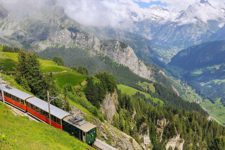
How to get back from Schynige Platte
A cogwheel train takes you from Schynige Platte down to Wilderswil. From there, you can travel by train or by car to Interlaken, Grindelwald or Lauterbrunnen. Be sure to reach Schynige Platte well before the last train departs.
Hiking directions
- Start following the signs to Schynige Platte.
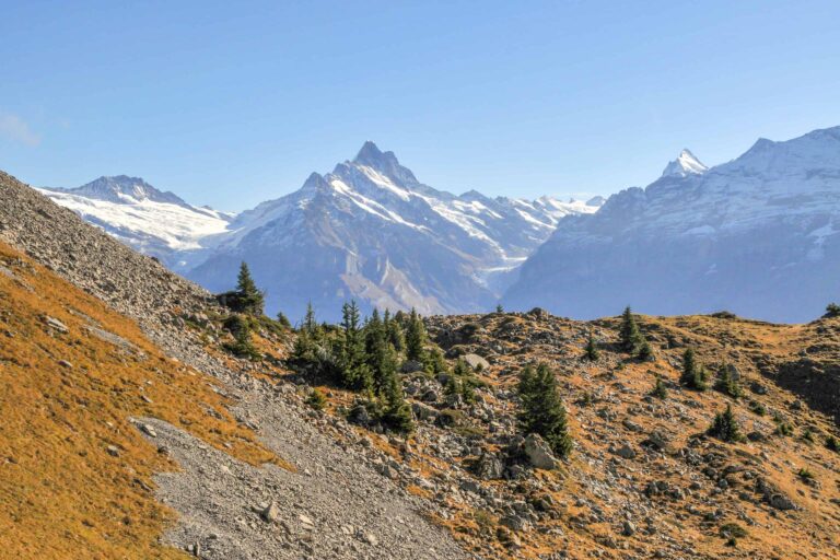
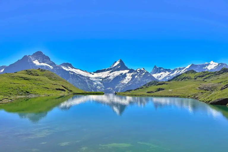
- The first section of the route leads you to the Bachsee. That’s where a considerable ascent starts, which brings you just under the top of the Faulhorn.
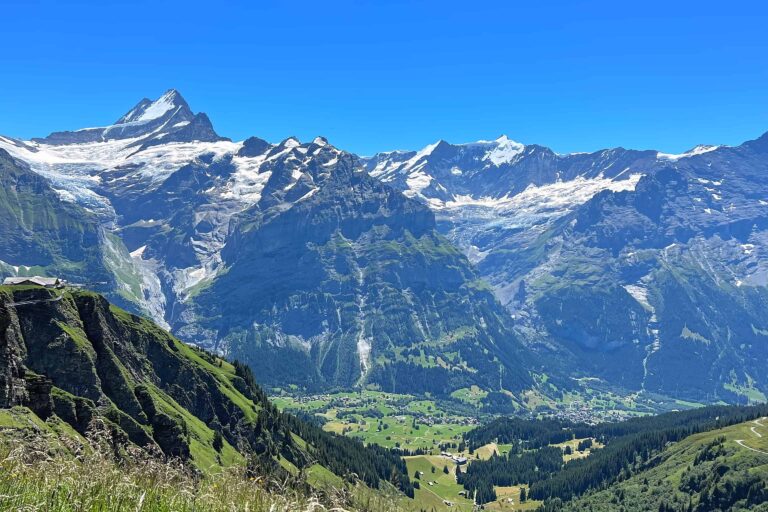
- What remains from here is a long but mostly gradual descent to Schynige Platte. After the steepest part, you will reach an authentic mountain hut in the middle of a desolate area with primarily rocks and stones: the Männdlenen hut (also known as the Weberhütte).
- Shortly after the Männdlenen hut, you will enter the green plateau of Schynige Platte. The last section of the route leads through meadows and is relatively easy.
- Before arriving at Schynige Platte, you need to choose whether to take the panorama route (recommended) or a lower-situated path which will take about an hour extra.
First-Schynige Platte hiking route on a map

- www.berghaus-maenndlenen: the Männdlenen Hut or Weberhütte
- www.faulhorn.ch: Faulhorn Hotel
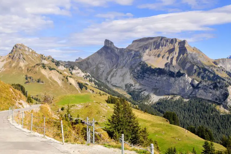
Grindelwald-First
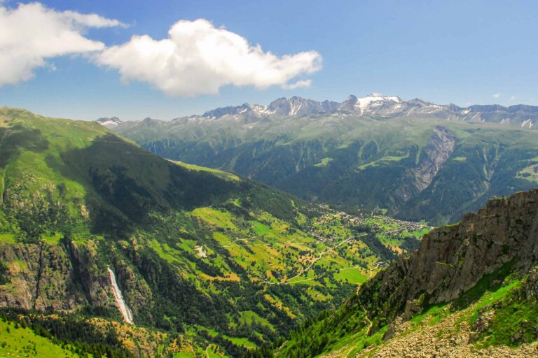
Schynige Platte

Preparation
Free with the Swiss Travel Pass in the Bernese Oberland

Hike Täsch-Zermatt

Hike First-Grosse Scheidegg
Hike First-Bachsee
Hike Kandersteg-Frutigen

Hike Grosse Scheidegg-Meiringen
Hike Schynige Platte
Hike Bettmerhorn-Märjelensee-Fiescheralp