 Min. time required: 2:00
 Season: early January to early March and late April to late December
 Recommended season: early January to late February and late April to late October
 Max. altitude: 2190 m (7185 ft)
What is the Stockhorn? 
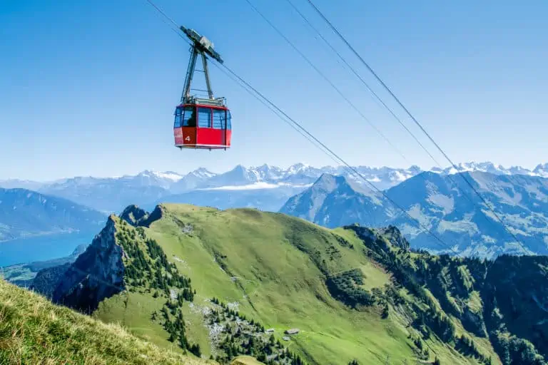
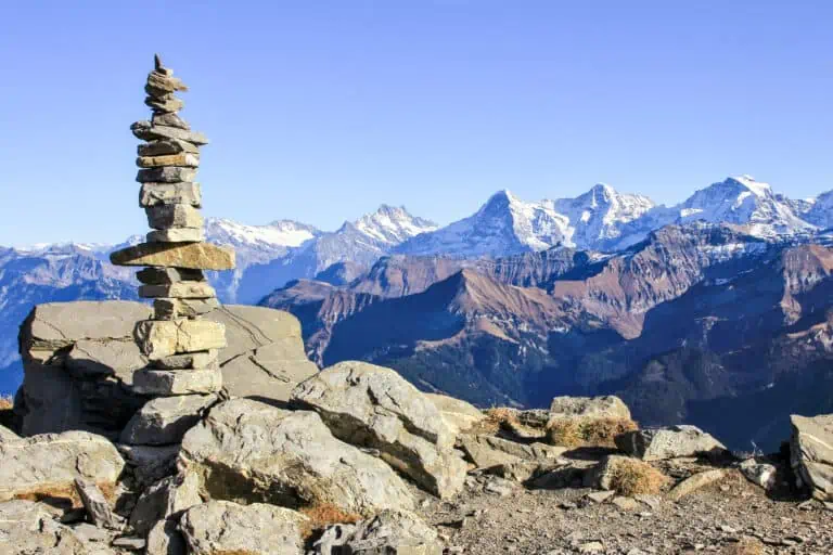
The Stockhorn is a Swiss viewpoint at 2190 m altitude. It's located above the village Erlenbach in the Simmen Valley (Bernese Oberland). The mountain station is just under the actual Stockhorn peak, which can be reached by an easy zig-zagging path.
The views from the top reach far: from the Bernese Alps in the south to the northern Swiss plains. The two mountain lakes at mid-station Chrindi provide excellent hiking, fishing and exploring opportunities.
Chrindi is also where you can make a bungee jump from a cable car, right above the Hinterstockensee.
Ticket prices and reservations
Standard prices of a trip to the Stockhorn
The standard fare for a return trip Erlenbach-Stockhorn is CHF 60 per adult in 2024. A return trip to mid-station Chrindi costs CHF 42. Several rail passes provide discounts or even free traveling.
Where to buy your Stockhorn tickets
Tickets can be bought online. Alternatively, you can get them at the valley station in Erlenbach and the mid-station Chrindi.
Find tickets

Offered by Swiss Activities: www.swissactivities.com
- Easy, online, free cancellation in most cases
- Extra Support: if you buy here, MySwissAlps can also assist if you have questions about your order.

Offered by Klook: www.klook.com
- Best price guarantee: Klook will refund double the difference if you find a lower price.
- Extra Support: if you book here, MySwissAlps can also assist if you have questions about your order.

Offered by GetYourGuide: www.getyourguide.com
- Easy, online, free cancellation in most cases
- Best Price Matching: GetYourGuide will pay the difference if you find a lower price.
- Extra Support: if you buy here, MySwissAlps can also assist if you have questions about your order.
Promotions
There are currently no promotions available.
How to travel to the Stockhorn: directions and map
The cable car departs from the village Erlenbach in the Simmen Valley. Count on these travel times for a single journey to the top:
- from Spiez or Zweisimmen: 1h00
- from Thun: 1h10
- from Bern: 1h30
- from Interlaken or Gstaad: 1h40
How to reach Erlenbach
Erlenbach is located at the beginning of the Simmen Valley. The village can be reached by train. There are regional trains from the directions of Bern/Thun/Spiez in the north-east and from Gstaad/Zweisimmen in the south-west.
From the Erlenbach station to the cable car valley station
A signposted 15-minute walk gets you to the cable car valley station.
From Erlenbach to Chrindi and Stockhorn
Board the cable car in Erlenbach. You'll have to make a change at the mid-station Chrindi. The total ride from the valley station to the top takes 20 minutes.
Map with the cableway route to the Stockhorn


Operation dates, schedules and timetable
Stockhorn operation dates 2024
The cable cars to Chrindi and Stockhorn operate from 15 November 2023 to 10 March 2024, and from 13 April to 10 November 2024.
How to plan your trip with the Swiss timetable
You can find all connections to the Stockhorn in the Swiss timetable. Use these names:
- "Stockhorn" for the top station
- "Chrindi" for the mid-station
- "Erlenbach i.S. (Stockhornbahn)" for the cable car valley station
- "Erlenbach im Simmental" for the rail station of Erlenbach
Best months for Stockhorn
The best seasons for a trip to the Stockhorn are early January to late February and late April to late October:
- January and February are great for a winter visit. If you aim for vistas of snow-capped Bernese mountain ranges, and possibly even snow down in the Simmen Valley, these months are your best shot.
- April to June and October are the months in which the scenery is best in my opinion. Vegetation down in the valley is lush and green (April-June) or beautifully varied with autumn colors (October). There's usually snow on the higher mountain peaks.
- July-September is perfect for hiking. Most high-altitude routes are accessible, including hikes along the mountain lakes near mid-station Chrindi.


Weather tips and forecasts
Check the weather forecast, as you can't enjoy the great panorama if the Stockhorn is covered by clouds.
If you plan to hike, make sure weather forecasts are stable and favorable. Rain, fog, snow, or thunderstorms can cause dangerous circumstances.
Stockhorn forecast for the next 5 days
The views from the top
The Stockhorn mountain station is located just below a high ridge. Towards the north, you’ll see the hills and plains of the lower Swiss territory, and in clear skies, the view reaches as far as the German Black Forest. The mighty Bernese Alps can be seen in the south.
The best views can be enjoyed in 2 ways:
- 1: From a thrilling platform sticking out from the rocks on the northern side. There’s even a glass cut-out allowing you to look 400 m down. A short path with information panels about the geology leads from the cable car station to the platform. The path and the platform are wheelchair-friendly.
- 2. From the actual top of the Stockhorn. A short zig-zagging path leads to the ridge with views in both northern and southern directions.
Restaurants at the Stockhorn
There’s a panorama restaurant at Stockhorn facing the Alps in the south. Apart from the normal cuisine, you enjoy these options:
- On Sundays, Saturdays, and Swiss public holidays a brunch buffet is organised. Advanced booking is recommended.
- On weekdays there’s a breakfast buffet from the first cable car ride until 11:00 am.
- From December to February, you can book moonlight dinners.
A smaller restaurant at mid-station Chrindi provides snacks and simple meals.
Summer hikes at Stockhorn and Chrindi
There are plenty of hiking trails, especially from the middle station Chrindi. Examples:
- Hike to the actual summit of the Stockhorn along the Alpine Flower Trail.
- Make the easy hike along the lake “Hinterstockensee”. This easy 1.7 km trail can be done in about 40 minutes and offers beautiful views of the mountain lake and the surrounding green peaks. There’s a “Quiz-Trail” brochure available for this route at the Erlenbach cable car valley station. It playfully teaches children about the local flora and fauna.
- Make a longer circular tour along two lakes: the Hinterstockensee and the Oberstockensee. Information panels teach children about the local geology, weather, and habitats. That’s why it’s also called the “Adventure trail”.


Other summer activities
- Make a bungee jump above the lake “Hinterstockensee at” Chrindi.
- Book a tandem paragliding flight.
- Go fishing in the lakes Hinterstockensee or Oberstockensee, to be reached from Chrindi.
- Hike to the Vorderstockenalp (40 minutes from Chrindi, 1 hour from the Stockhorn) and then get down to Erlenbach on trotti bikes.
Winter activities at Stockhorn and Chrindi
In winter groomed hiking trails from the middle station Chrindi are available. In addition, there are 4 snowshoe trails, and snowshoes can be rented on the spot at Chrindi.
If ice conditions are favorable, skating at the Hinterstockensee is possible. Ice fishing is another option. Gear can be rented at Chrindi.
Other websites of interest
Schedules
- www.stockhorn.ch: Stockhorn timetable winter
- www.stockhorn.ch: Stockhorn timetable summer
Prices
- www.stockhorn.ch: Stockhorn ticket prices
More activities close to Stockhorn
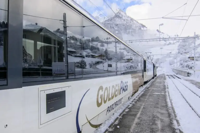
GoldenPass
Niesen

Boat Lake Thun
All our info about the Bernese Oberland and nearby towns

Bernese Oberland