 Region: Engadine
 Recommended season: early January to mid March, early June to mid October and mid December to late December
 Altitude: 1775 m (5823 ft)
 This is a winter sports resort
 Town size: Small
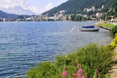
 This town is on a lake
 Local language: German
 There is a train station
What to see and do in St. Moritz 
Find excursions in and near St. Moritz

Offered by GetYourGuide: www.getyourguide.com
- Easy, online, free cancellation in most cases
- Best Price Matching: GetYourGuide will pay the difference if you find a lower price.
- Extra Support: if you buy here, MySwissAlps can also assist if you have questions about your order.

Offered by GetYourGuide: www.getyourguide.com
- Easy, online, free cancellation in most cases
- Best Price Matching: GetYourGuide will pay the difference if you find a lower price.
- Extra Support: if you buy here, MySwissAlps can also assist if you have questions about your order.
Mountain visits near St. Moritz
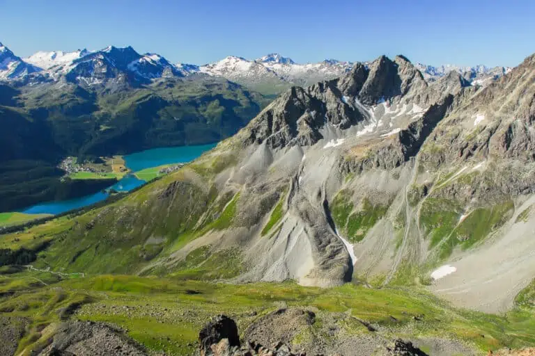
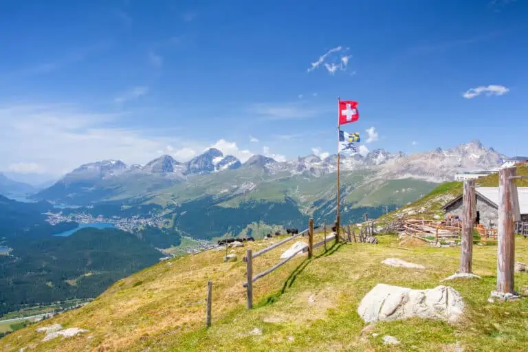
You can enjoy the sweeping views over the valley's lakes and surrounding hills from several mountaintops close to the town. Examples are Piz Nair, the Signalbahn, Corvatsch, and Muottas Muragl.
Summer hiking
Hiking is one of the best ways to explore St. Moritz and surroundings. Some of our personal favorites are:
- The Via Engiadina ("Engadine trail"): a long-distance route crossing the Engadine. You can choose any section you want. We specifically like the gorgeous lake section between Maloja and Sils, a bit west of St. Moritz.
- The hike from Murtèl (half-way up to Corvatsch) to Pontresina through the Roseg Valley.
- The long descent from Piz Nair to Bever, through the wonderful valley "Val Bever".
- The panoramic trail from Muottas Muragl to Alp Languard.
Winter activities in St. Moritz
St. Moritz is a perfect winter destination. Most other towns in the Upper Engadine are great snow resorts as well. The valley is located at high altitude, so you’ll see white mountains and snowy villages.
St. Moritz is home to the Olympia bob run. Each year, several championships are held here. Tourists can make a guest ride with an experienced bobsleigh pilot.
In the coldest month, the entire lake of St. Moritz is usually frozen. You can enjoy winter golf, ice skating, curling and more on the ice.
The large ski area of Corviglia-Piz Nair can be reached directly from town. Many other snow areas are close by. Examples are Corvatsch and Muottas Muragl.
Further winter activities near St. Moritz are sledding, winter hiking, snowshoe hiking and ice sports. You can also make a horse-drawn sleigh ride from Pontresina to Val Rosegg.
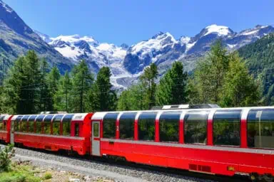
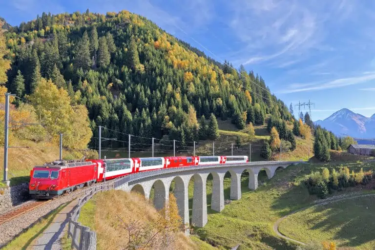
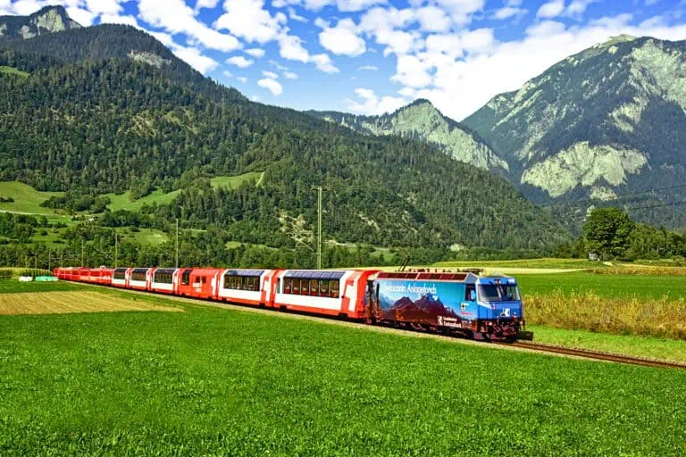
Train and bus trips from St. Moritz
St. Moritz is the perfect base for very scenic train and bus trips. Our recommendations:
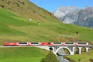
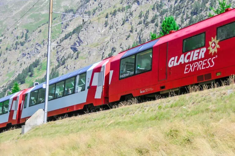
- Make the Glacier Express ride from or to St. Moritz.
- Make a day trip with the Bernina Express, either to Chur in the north or to Tirano in the south.
- Ride toward Zernez and the Swiss National Park in the Lower Engadine.
- Take the bus to Maloja in the west, or even further down into the Bergell Valley. This is part of the Palm Express bus ride between St. Moritz and Lugano.
Travel info and map of St. Moritz
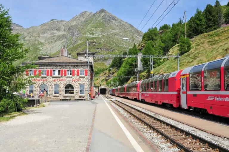
How to reach St. Moritz by train
St. Moritz is south-eastern Switzerland. It takes some time to get there from the major Swiss cities in the north and west.
St. Moritz can best be reached by train. The two recommended scenic routes are the famous Glacier Express from Zermatt/Chur, and the Bernina Express from either Chur in the north or Tirano in the south.
But there are many more connections. Examples of travel times from Swiss airports and towns:
- 3h20 from Zurich Airport, 3h05 from Zurich
- 4h40 from Basel EuroAirport, 4h10 from Basel
- 6h05 from Geneva Airport, 6h00 from Geneva
- 6h40 from Zermatt by regional trains, 7h45 by Glacier Express
- 2h10 from Tirano
- 2h05 from Chur
- 1h40 from Davos
Use the Swiss timetable to plan your trips to and from St. Moritz.
Travel passes to be used in and around St. Moritz
Our Engadine travel guide lists all passes and local hotel offers that provide free and discounted traveling in the St. Moritz area.
How to travel to St. Moritz by car
St. Moritz can also be reached by car. There are no highways nearby. You'll need to cross one or more mountain passes to get there. Examples:
- The Albula Pass, Julier Pass or Flüela Pass if you drive from the north.
- The Bernina Pass if you arrive from Tirano or a nearby Italian town.
- The Oberalp Pass if you drive from Andermatt.
- The San Bernardino Pass if you enter from the Ticino.
In winter, most passes are closed and the car train from Selfranga (Klosters) to Sagliains can be used to reach the Engadine.
There are several paid parking options in St. Moritz. The Serletta garage close to the rail station is recommended. Up in the town center, there's the smaller parking garage Quadrellas.
How to reach St. Moritz by plane
If you fly into Switzerland, you'll probably land at the airports of Zurich, Geneva or Basel. From there, you can continue your journey to St. Moritz by train.
The larger Swiss airport closest to St. Moritz is Zurich Airport. From there, it's a 3h30-train ride to St. Moritz.
There's a also small airport in the nearby village Samedan, but this is only used for private charter flights.
The rail station
St. Moritz only has one rail station. This is where the Glacier Express and all local trains and buses depart.
From here, you can easily travel to all the attractions in the region.
How to travel in St. Moritz
The town center is compact and can easily be explored on foot.
St. Moritz is built on a hill. The actual town center is above the rail station. It takes a 5- to 10-minute uphill walk to get from the station to the town center.
Buses to several districts of the town are available too.
The rail station in St. Moritz is the starting point for all day trips in the region.
The escalators between the station/car parking and town
If you don't want to walk or ride the bus, you can use the high escalators from the station level to the town center (up the hill).
You'll find them on the Via Serlas, just west of the train station. The escalators are also quickly accessible from the Serletta parking garage.
St. Moritz-Bad
The district St. Moritz-Bad is at a 20-minute walk from the rail station, and can be reached by bus too. It's south of the town and on the lake.
St. Moritz on a map of Switzerland


When to visit St. Moritz
The best months for a trip to St. Moritz are early January to mid March, early June to mid October and mid December to late December.
St. Moritz in summer and autumn: June to mid-October
St. Moritz is in a high mountain valley, at nearly 1800 m altitude. Spring and summer set in later here than in lower areas of Switzerland.
In most cases, mountain transportation is operational from June until mid-October. This is also the best time for a summer or autumn visit. You can enjoy most hiking trails, bus rides, train rides and mountain visits in these months.
Early- to mid-October is a great time for a visit. The many coniferous trees in the valley of St. Moritz take on splendid shades of yellow and orange by this time.
St. Moritz in winter
The best time for a snow holiday in the Upper Engadine is December to mid-March. That's when snow in and around the village is most likely.
Snow can set in earlier than December, and continue can until March or even April.
The weather in St. Moritz
What is the weather in St. Moritz like?
Due to its high elevation, temperatures in St. Moritz are significantly lower than in many other Swiss towns: average daytime temperatures are between 14°C and 19°C in summer, and between -3°C and 2°C in winter.
Frost is very common, both at night and during the day. Learn how to dress appropriately with our tips about clothing.
The Upper Engadine is a relatively dry and sunny corner of Switzerland. But rainfall does occur. Most of this is June, July, August and September. Showers are more common than continuous rain.
The winter months are drier. And during the coldest months, it won't rain but snow.
5-day weather forecast for St. Moritz

Accommodation in St. Moritz.
Holiday homes
Most rentals are cheaper than hotels. You either go out for dinner, or cook your own meals.
The large COOP supermarket between the town center and St. Moritz-Bad makes shopping and cooking part of the fun. There are plenty of restaurants in St. Moritz as well.
Hotels
There are many hotels in St. Moritz to choose from. Our St. Moritz hotel guide helps you out.
Hotels in St. Moritz, Switzerland
What St. Moritz is like
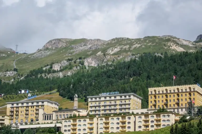
St. Moritz is luxurious and sporty
St. Moritz is one of the most exclusive towns in the Alps. This is where the rich and famous spend their holidays or own a chalet. Winter sports, hiking, fine dining and luxury shopping can easily be combined here.
Location and scenery
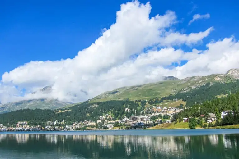
The town is the center of the Upper Engadine Valley. It is situated at an altitude of 1775 m along the small St. Moritz lake, called “Lej da San Murezzan” in Rhaeto-Romanic and “St. Moritzersee” in German. The town is built on a slope. Some streets are steep and the highest chalets are located 200 m over the lake.
St. Moritz is surrounded by forests and high mountains. There are more beautiful lakes further west in the valley. You can start hiking directly from town.


Pros and cons of St. Moritz
St. Moritz isn’t the typical scenic alpine town. We feel that ‘luxurious’ is a more appropriate description than ‘beautiful’. The surrounding area is beautiful though, and combined with the special atmosphere of the town, a wonderful vacation is guaranteed.
St. Moritz makes a perfect base to explore the south of the canton of Graubünden. It’s not a good base for day trips to other parts of Switzerland, as that would take too much travel time.
Apart from the nightlife in town, the main activities here are in the outdoors. If you like hiking, biking, or winter sports, you can enjoy yourself for weeks in this stunning region.
St. Moritz FAQ
-
Where is St. Moritz located?
St. Moritz is situated in south-eastern Switzerland, at a 3h20-train ride from Zurich. It’s in the Upper Engadine Valley, which is part of the large canton Graubünden.
-
Is St. Moritz worth visiting?
Yes. Even though the town center is more “classy” than “beautiful”, St. Moritz is worth visiting. Its location on the small lake, and the beauty of the surrounding Engadine Valley, are amazing.
-
Is St. Moritz expensive?
St. Moritz can be expensive. It offers some of Switzerland’s most famous luxury hotels, and attracts the rich and famous. But budget accommodation is available too, and you can make all sorts of cheap trips.
Other websites of interest
- www.schweizmobil.ch: the Via Engiadina
- www.postauto.ch: the Palm Express bus ride
Itineraries including St. Moritz
Glacier Express: 3-day classic tour from Zurich
Glacier Express: 4-day slow-paced tour from Zurich
Ultimate scenic trains


Related blog articles
Glacier Express reservations
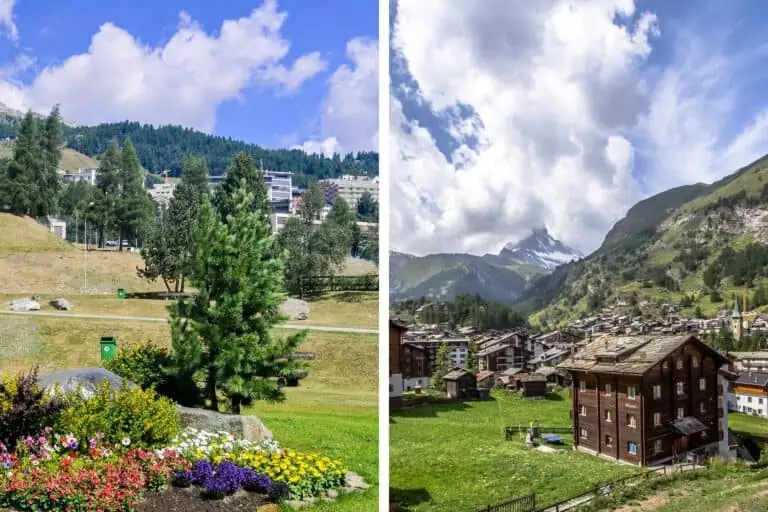
St. Moritz vs Zermatt