 Main towns:
  Recommended season: early January to late February, mid April to late October and late December
Things to do and places to visit in Graubünden 
The canton of Graubünden is full of varied activities and excursions. Also check our Engadine guide, in which we provide additional activity tips for that region.
Travel info and map
How to travel to Graubünden
As in all of Switzerland, train and bus routes to Graubünden are excellent. Which route to use, depends on your destination in this large canton.
Traveling to Graubünden from the north
Chur, the main town of northern Graubünden, can best be reached from Zurich. This scenic train ride along Lake Zurich and the Walensee ("Lake Walen") takes 1h15 to 1h30, and there are several direct trains.
If you come from Austria, you'll enter Switzerland at Buchs SG. You'll then continue south toward Chur via Sargans and Landquart. Find more details about a journey from Austria here.
Entering Graubünden from the west
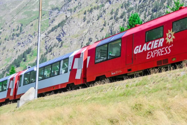
The main train line west of northern Graubünden is the one via Andermatt and the Oberalp Pass, which also part of the Glacier Express route. Andermatt-Chur takes about 1h50.
If you travel to Graubünden from the Ticino, there are several options:
- Make a bus ride from Bellinzona to Thusis via the Splügen Pass. The Bellinzona-Thusis bus journey takes about 1h50.
- Enjoy the Palm Express bus route from Lugano to St. Moritz in the Upper Engadine. You'll travel via Chiavenna in Italy and through the lovely Bergell Valley. This ride takes a bit over 3h30.
Traveling to Graubünden from the south
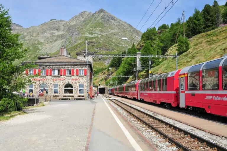
Southern Graubünden borders Italy, so that's where many travelers come from. The obvious route is the Bernina train route from Tirano at the border. Tirano-St. Moritz takes about 2h15 by train, Tirano-Chur takes approximately 4 hours.
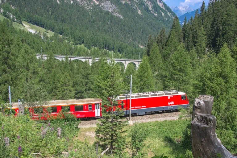
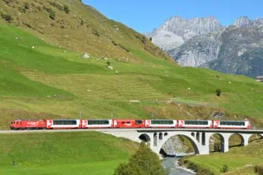
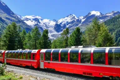
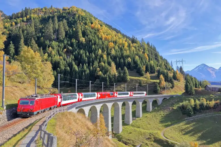
The Rhätische Bahnen: Graubünden's railway company
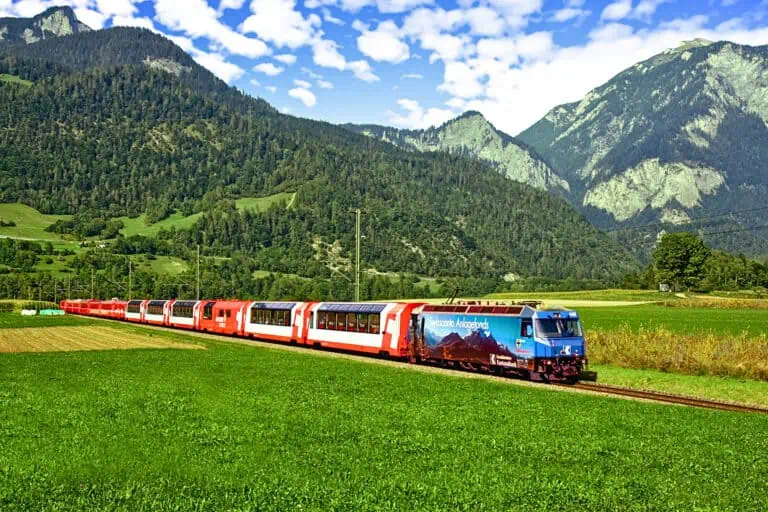
Graubünden has its own railway company: the Rhaetian Railway (abbreviated with "RhB", which stands for its German name "Rhätische Bahnen"). The excellent narrow-gauge rail network stretches out to most corners of Graubünden. We find the red trains of the RhB a pleasure to travel with.
The flagship of the RhB is the Bernina Express from Chur to Tirano.
In addition to the trains, there are buses and cable cars which go where trains don't. This goes for the villages west of St. Moritz and for the Swiss National Park near Zernez, for example.
Traveling by car
Because of the excellent public transport, a car is not a necessity to explore Graubünden.
If you plan to drive in winter, note that many passes will be closed. You will have to use a car train to cross the mountain range between the Engadine and the north of Graubünden, and also to enter Graubünden from the west (Oberalp Pass). Also, some main roads in the higher valleys may be covered with snow, so your vehicle and driving skills need to be up to those conditions.
Train passes
Besides the nation-wide rail passes, there is a graubündenPASS. It is worth looking into that pass if you plan to stay in Graubünden only. It doesn't include most mountain transport though.
The map of Graubünden in Switzerland

The best months to visit Graubünden
We think that the best time for a stay in Graubünden is early January to late February, mid April to late October and late December. That's because nature and outdoor activities are the main reasons to visit this canton. To us, Graubünden's scenery is less appealing from March to mid-April, and from November to mid-December.
Winter holidays in Graubünden
Winter sports and snow holidays in Graubünden can best be planned between late December and late February. In ski areas at high altitudes, such as the Upper Engadine, the snow season may start earlier and last significantly longer: until well in March and sometimes even April. But that's not guaranteed.
Spring, summer, and fall holidays
April to October is recommended for hiking, cycling and other outdoor activities. April and May can be too early for hiking at high altitudes, but there are plenty of easy valley trails to enjoy Graubünden's nature.
A similar remark goes for October: if autumn sets in early, snow may already cover alpine hiking routes. But Graubünden's splendid fall vegetation is too beautiful to not recommend October.
Weather in Graubünden
Graubünden is a very large canton, with significant regional variations in weather patterns.
Northern Graubünden
In general, the areas north of the Engadine have a mild and moist climate, with lush green vegetation. The wettest months are May to August.
Temperatures vary by altitude. For example:
- In Chur at 592 m altitude, daytime temperatures range from 20°C to 25°C in summer. In winter it can get 6°C to 10°C degrees during the day.
- Arosa is relatively close to Chur, but located at 1775 m altitude. Typical daytime temperatures in summer are 12°C to 15°C, and winter temperatures can be around freezing.
Southern Graubünden
The Engadine is at high altitude and relatively dry. It has its own climate. Please find more details in our Engadine guide.
The Moesa area west of Ticino, and the Poschiavo Valley south of the Bernina Pass, are more like the Ticino weather-wise.
5-day forecast for Bergün in Graubünden
Below is the forecast for Bergün, a village located in the middle of the canton. This is an example. Always consult local and short-term forecasts for your specific destination: there can be significant differences per sub-region and per town.
Accommodation in Graubünden
Larger towns like St. Moritz, Davos and Chur have plenty of hotels to offer. In smaller towns you'll usually find one or more hotels too, but holiday rentals are more common there.
Hotels in St. Moritz, Switzerland
Our hotel suggestions for Davos - budget to 5-star
Why we love Graubünden
We’ll probably never be able to pick an absolute favorite Swiss region, just because there’s so much natural beauty throughout the country. But Graubünden is very high on our list. It’s somewhat different from other Swiss regions. Examples:
- The Bündner, the people of Graubünden, speak Swiss-German, Italian or Rhaeto-Romanic, depending on the subregion.
- Culture and architecture vary along with the local languages. The Rhaeto-Romanic areas, and the Engadine Valley in particular, have their own charm. Unlike other Swiss mountain regions such as the Bernese Oberland and the Valais, you’ll see few wooden chalets here. Most buildings are made with thick, white-plastered walls. These are adorned with pastels, drawings, and wise sayings in Rhaeto-Romanic.
- You can still feel how these high valleys were once very isolated, especially in winter. In a way, some still are. There aren’t many expressways in Graubünden, so you have to spend some traveling time to get there. There’s an excellent train system though, which we highly recommend using.
- We also love the nature/city ratio: there’s lots of nature and no real cities, just some larger towns and small villages. If you like city trips, Graubünden is not the place to go to.
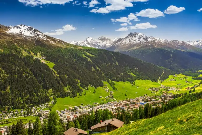
What Graubünden looks like
The large canton of Graubünden can roughly be devided into two areas: northern Graubünden (the area between Landquart in the north and the Albula Pass in the south) and southern Graubünden (the Engadine, the Moesa region and the Poschiavo Valley).
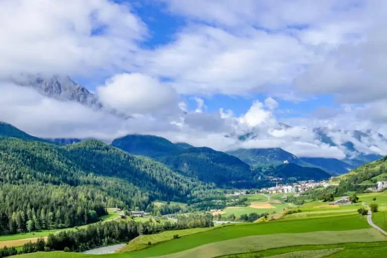
In northern Graubünden, expect beautiful green valleys and hills, with quaint villages and ancient castles. The areas with the highest mountain peaks can be found near Arosa-Lenzerheide and Davos.
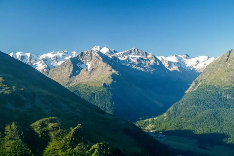
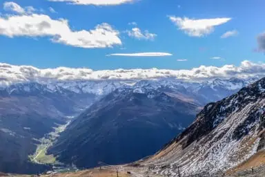
Southern Graubünden is very diverse. The Moesa area, the Bergell Valley and the Poschiavo Valley are at relatively low altitude. They’re a bit like Italy in terms of scenery and weather. The long Engadine Valley is at a much higher elevation. This is where you’ll find high mountain peaks, lakes, and lots of side valleys for amazing hikes.
Where to stay in Graubünden
In our opinion, some of the best places in Graubünden year-round are Chur, Davos, St. Moritz and Zernez. Consider Davos, St. Moritz, Arosa or Samnaun for a winter visit.
Details:
- Chur is a central base for trips in northern Graubünden, the southern part of the St. Gallen canton, and Liechtenstein. The well-preserved old town center is charming.
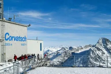
- Arosa, south of Chur, is a beautifully located town at high altitude. It offers a large ski area together with nearby Lenzerheide.
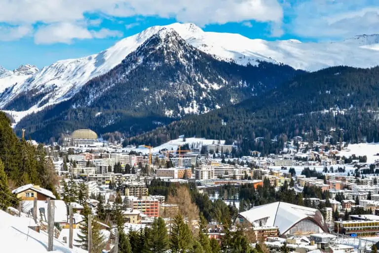
- Davos is a good choice for outdoor activities in both summer and winter. The surrounding mountains make for great skiing, hiking, paragliding, and more.
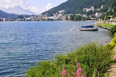
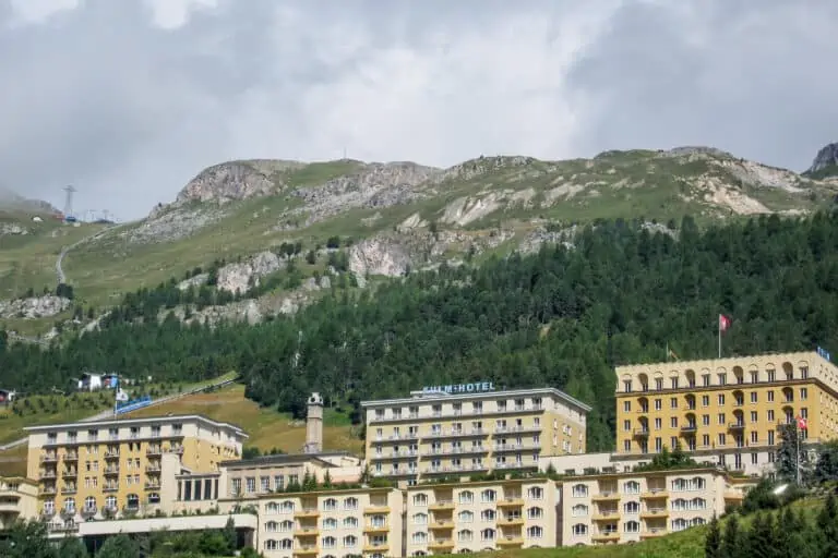
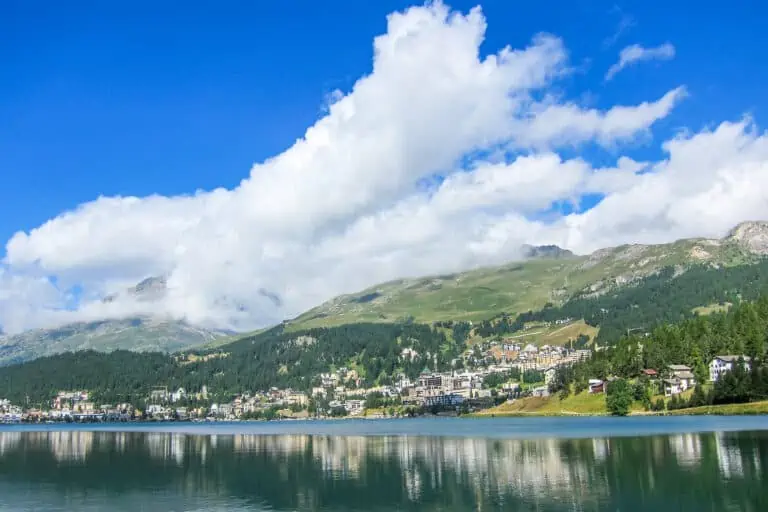
- St. Moritz is a classy winter sports resort. But it’s a wonderful base for hiking, mountain visits and scenic train journeys in winter too. There are several towns close to St. Moritz that are perfect cheaper alternatives.
- Zernez is one of the best towns for trips in the Lower Engadine and to Switzerland’s National Park.
- Samnaun in the north-eastern corner of the canton is an excellent winter sports destination. It takes some time to reach it, but that’s worth it.
Apart from these recommendations, there are many, many more great destinations in Graubünden. We’ll describe them below.
The regions and towns of northern Graubünden
As in the rest of Switzerland, the scenery is very different around every corner. We’ll provide a short impression of what to expect for each sub-region in northern Graubünden:
- Surselva (the Rhine Valley)
- Imboden (the region of the town Domat/Ems)
- Hinterrhein (the “Posterior Rhine” area with Thusis and the Splügen Pass)
- Plessur (the area around the town of Chur)
- Landquart (the canton’s northern corner, bordering on Liechtenstein)
- Prättigau (the area of Davos and Klosters)
- Albula (the valley crossed by the Glacier and Bernina Express with Tiefencastel, Filisur, and Bergün)
1. Surselva (the Rhine Valley)
The Rhine Valley can be found in the north-western part of Graubünden. The Glacier Express offers a quick way to see this beautiful region. Part of the valley is called the “Swiss Grand Canyon”, because the river has carved its way deep into the white rocks.
Some of the larger villages are Sedrun (“Tujetsch” in Rhaeto-Romanic) and Disentis/Mustér. There are cable cars to several peaks in this area, that operate in both summer and winter.
2. Imboden (Domat/Ems)
This area is east of the Surselva. The wider Rhine Valley begins here. The municipality of Domat/Ems is one of the largest in Graubünden, so there are plenty of facilities. The village is built between so-called “Tumas”: small hills that were formed from the debris of past landslides.
Domat/Ems is close to Chur, the Hinterrhein area, the Albula Valley, and Landquart.
3. Hinterrhein (Thusis)
The Hinterrhein area is large and stretches from north to south. Its backbone is the river Hinterrhein. The narrow gorge through which it flows is known as the “Viamala”, which literally means “bad road”.
One of the main towns in the Hinterrhein area is Thusis in the north. Between Thusis and Domat/Ems is one of the prettiest regions of not only the Hinterrhein, but even all of Graubünden: the Domleschg. This valley is known for its ancient castles and fortresses, and great hikes can be made here.
In the south-west, it borders the Moesa area which can be reached by the San Bernardino Pass. The Splügen Pass forms the connection between the Hinterrhein area and the Italian town of Chiavenna.
Worth mentioning is the tiny settlement of Juf in the southern Hinterrhein area. At an altitude of 2114 m, it’s one of the highest villages in Europe inhabited all year round.
4. Plessur (Chur)
Chur is the main city in Graubünden. It’s primarily known for being on the routes of the Glacier Express and the Bernina Express. Chur is Switzerland’s oldest city, and its well-preserved old town center is very attractive. We think it’s a good town to base yourself if you want to explore northern Graubünden and nearby St. Gallen. You can also visit the local mountain of Brambrüesch.
Another town worth visiting is Arosa, south of Chur. This mountain resort can be reached with a magnificent 1-hour train journey from Chur. The mountains between Arosa and the nearby town Lenzerheide form an attractive ski and hiking region.
5. Landquart
Landquart is in the very north of Graubünden, bordering the canton of St. Gallen in the east and Liechtenstein in the north. It’s on the route of trains between Zurich and Graubünden.
Landquart isn’t the most scenic town, with its industrial area and large fashion outlet. But it’s a good base for trips to Vaduz in Liechtenstein and for activities in southern St. Gallen. Examples are:
- the Tamina Gorge
- the spa resort Bad Ragaz
- Heidi Dorf in Maienfeld
- the beautiful Walensee (“Lake Walen”)
6. Prättigau (Davos-Klosters)
The large region of Prättigau borders Austria. The main towns here are Davos and Klosters. Davos is a famous winter sports and spa resort, but very much worth a visit in summer too. Learn all about it on our extensive Davos page.
7. Albula Valley (Tiefencastel, Filisur, Bergün)
The Albula Valley is named after the Albula river. The valley is crossed by the Glacier Express and Bernina Express trains on their way to the Engadine in southern Graubünden. The famous Landwasser train viaduct can be found here. The scenery consists of forested green valleys, which are sometimes wide and sometimes narrow like a gorge.
The main villages here are Tiefencastel, Filisur and Bergün. We personally love Bergün’s pretty town center with its typical Graubünden-style buildings. It’s also a good base for hiking in summer and sledding in winter: the long sled run from Preda to Bergün ends here.
A mountain range forms the southern border of the Albula Valley. The Albula pass road leads from the Albula Valley to La Punt-Chamues-ch in the Upper Engadine. Trains use the Albula Tunnel and arrive in Bever in the Upper Engadine.
South of Tiefencastel is “Parc Ela”, Switzerland’s largest nature park that encompasses a large area: roughly between Bonaduz, the Splügen Pass, the Albula Pass and Davos.
The regions and towns of southern Graubünden
- Moesa
- Engadin (the Engadine)
- Berninapass (the Bernina Pass) and Val Poschiavo (the Poschiavo Valley)
1. Moesa
The Moesa region is a south-western part of Graubünden that borders on the canton of Ticino. It contains the San Bernardino Pass, which leads to the Hinterrhein valley in the north.
The area consists of two valleys: the Mesolcina valley, also called “Misox”, and the Calanca Valley. The latter contains the smallest of Switzerland’s regional nature parks.
2. Oberengadin (the “Upper Engadine”) and Unterengadin (the “Lower Engadine”)
The long Engadine Valley runs through a large part of southern Graubünden. We explain all about this fantastic holiday area in our guide about the Engadine.
3. Bernina Pass and Poschiavo Valley
South of the Upper Engadine is the Bernina Pass region: a stunning alpine area defined by high mountain peaks, the Morteratsch Glacier and the lake “Lago Bianco”. The Bernina Express crosses this pass. It’s also perfect for relatively easy high-altitude hikes and visits to the mountains Diavolezza and Lagalb.
After a spectacular descent from the Bernina Pass, you’ll reach the Italian-like Poschiavo Valley. It’s also called “Puschlav”. It’s much lower and thus warmer than the Engadine.
The main villages here are Poschiavo and Brusio. Brusio is famous for the spiral viaduct used by trains on the Bernina route. The valley ends at Tirano, which is just south of the Swiss-Italian border.
Other websites of interest
- www.surselva.info: Surselva-Rhine Gorge Tourism
- chur.graubuenden.ch: Domat/Ems
- www.viamala.ch: Hinterrhein-Viamala Tourism
- chur.graubunden.ch: Chur Tourism
- www.arosalenzerheide.swiss: Arosa-Lenzerheide Tourism
- berguen-filisur.graubuenden.ch: Bergün-Filisur Tourism
- www.parks.swiss.ch: nature park Parc Ela
- www.visit-moesano.ch: Moesa Tourism
- www.parks.swiss: nature park Parco Val Calanco
- www.valposchiavo.ch: Poschiavo Valley Tourism
Towns in Graubünden
St. Moritz
Itineraries that include Graubünden
Glacier Express: 3-day classic tour from Zurich
Glacier Express: 4-day slow-paced tour from Zurich
Ultimate scenic trains
Graubünden in our blog articles
Glacier Express reservations