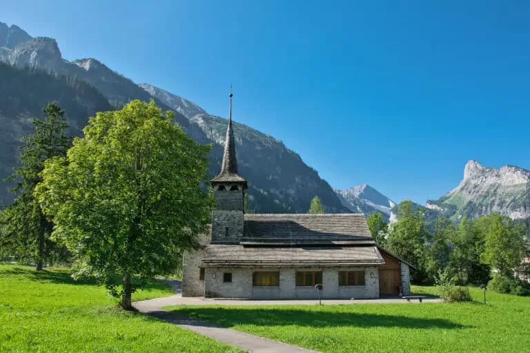
 Main towns:
  Recommended season: early January to late February and early April to late October
Attractions and activities 
Find your excursions and tickets in the Bernese Oberland.
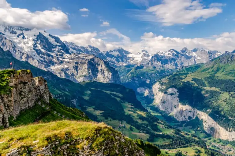
What not to miss in the Bernese Oberland
If your time in the Bernese Oberland is limited, these 3 types of activities offer you sufficient variation:
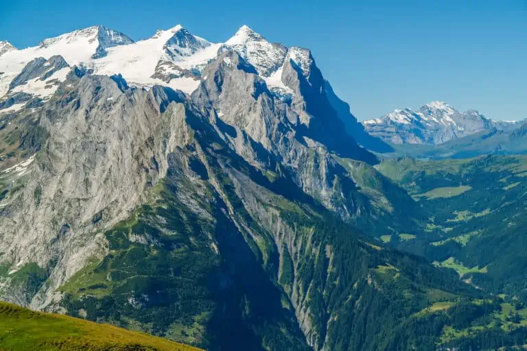
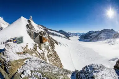
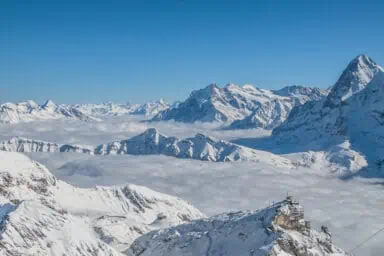
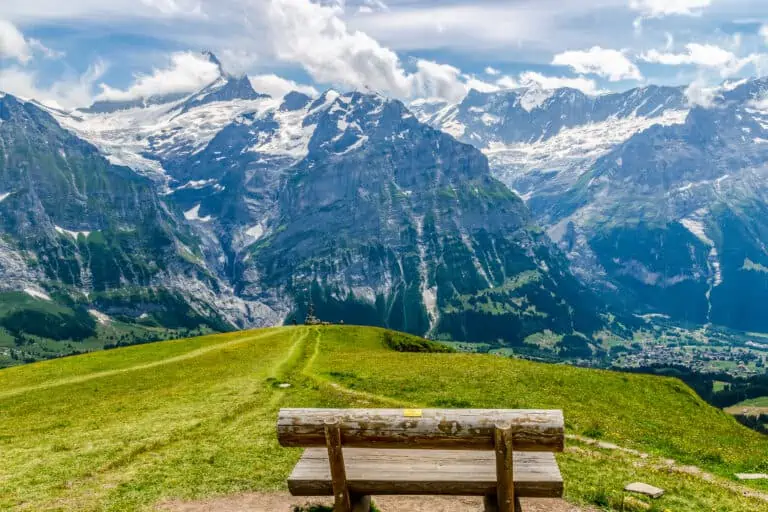
- Visit a mountaintop with up-close views of the highest peaks in the Jungfrau Region. We feel that the Jungfraujoch is a true highlight. It's spectacular to visit the world of eternal snow. If you prefer a cheaper excursion option, consider Schilthorn, Grindelwald-First, Schynige Platte, or Männlichen.
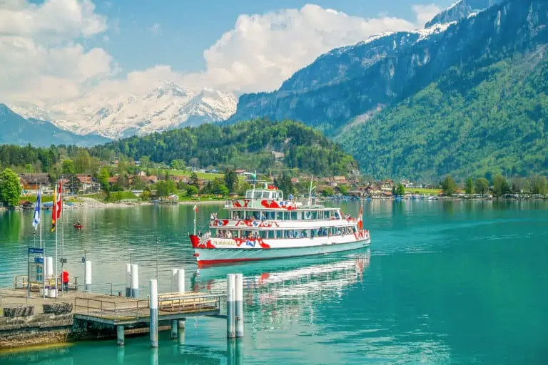
- Make a boat trip on Lake Thun or Lake Brienz.
- To us, exploring the area on foot is a must-do too. Even if you're not a hiker, we think you'll enjoy one of the short, easy and very scenic trails. Walk along the shore of Lake Thun to Spiez for example, or follow the valley path from Lauterbrunnen to Stechelberg.
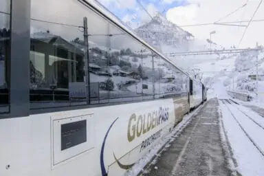
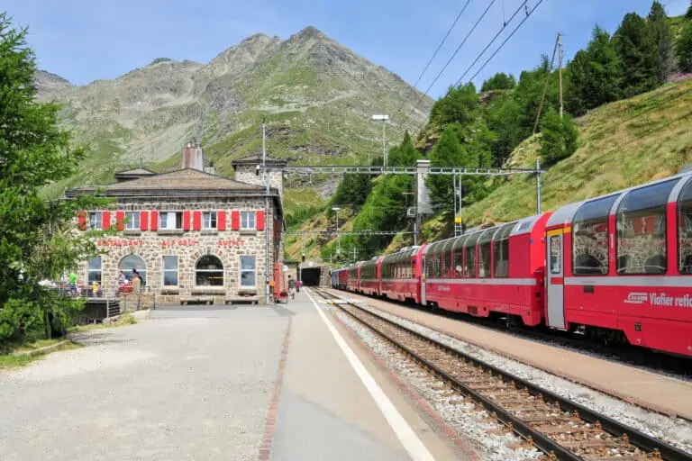
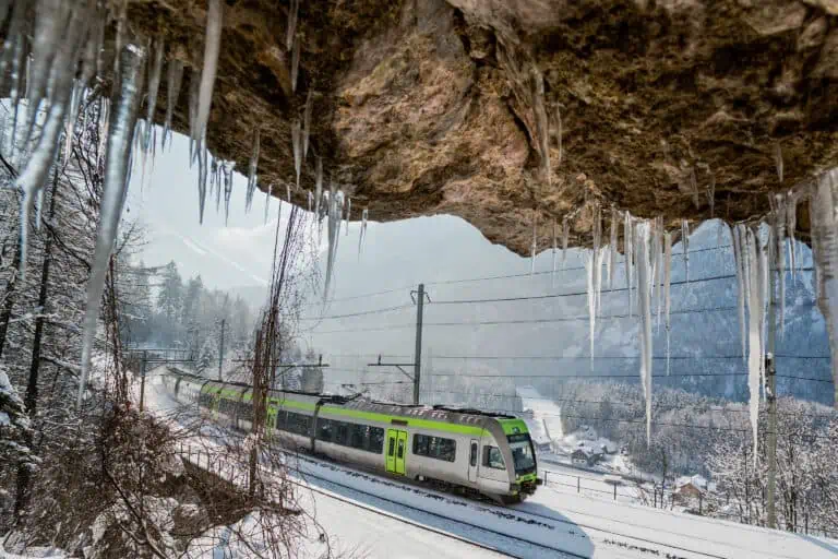
Scenic trains in the Bernese Oberland
Nearly all train rides in the Bernese Oberland can be classified as scenic.
Legs of the GoldenPass route
Some rail sections in the Bernese Oberland are part of the famous GoldenPass line:
- The ride from Gstaad to Zweisimmen and Spiez on Lake Thun.
- The leg from Spiez to Interlaken on the southern shore of Lake Thun. The western part, from Thun to Spiez, isn't part of the GoldenPass, but it's pretty too.
- The ride from Interlaken to Brienz on the northern shore of Lake Brienz, Meiringen and the Brünig Pass.
The northern part of the Lötschberg Mountain Railway
A favorite train ride of ours is the Lötschberg mountain route. It starts in Bern, then passes Thun, Spiez and Kandersteg. There, the impressive mountain route toward the Valais begins.
Cogwheel trains
If you love scenic trains, we think you'll be interested in the cogwheel rides to Schynige Platte and the Brienzer Rothorn. In both cases, a nostalgic train ride is combined with wide views that unfold as the trains climb to the top.
Traveling to and in the Bernese Oberland, plus map
How to get to the Bernese Oberland by train
The best route to the area depends on your exact destination. The Bernese Oberland has many sub-regions and towns, so always check the timetable for your specific journey.
We'll take Interlaken as an example here, as it's centrally located in the Bernese Oberland. The main train routes are:
- From the north-west, starting in Basel and traveling via Bern and Thun. Basel-Interlaken takes about 2h00.
- From the north-east, starting in Zurich. You can either travel via Bern (1h55), or via Lucerne on the northern part of the GoldenPass route (2h45).
- From the south-west, starting in Geneva. You can travel either via Fribourg and Bern (2h45), or via Montreux and Zweisimmen, which is the southern section of the GoldenPass route (4h30 to 5h00).
- From the south, starting in the canton of Valais. From Brig, you'll either take the Lötschberg Base Tunnel (1h10) or the scenic regional Lötschberg mountain trains (1h50).
Driving to the Bernese Oberland
You can reach most of the Bernese Oberland by car as well. You'd use roughly the same routes as explained for the trains above.
Note that you need to cross the Brünig Pass if you drive from Lucerne and that you need to use the Lötschberg car train if you enter from the Upper Rhone Valley in the Valais.
Car-free areas
The Jungfrau Region is car-free beyond Grindelwald and Stechelberg (near Lauterbrunnen). The villages of Wengen, Mürren and Gimmelwald cannot be reached by car. This means they're great spots to enjoy the alpine scenery without any nearby traffic.
The town center of Gstaad is car-free as well.
How to get around in the Bernese Oberland
Unless you have planned to visit really remote areas, such as the network of pass roads east of Meiringen, a car is not necessary to explore the Bernese Oberland.
There is a fantastic network of trains, buses and cable cars that go almost anywhere, so we recommend using public transport. Please find a comparison between modes of traveling here.
The Bernese Oberland is large, so you can't see and do all of it in just a couple of days. Traveling times for excursions strongly depend on your base town. Let's take Kandersteg as an example:
- If you're based here, it's easy to reach local attractions such as the lakes Oeschinensee and Blausee.
- But a single journey from Kandersteg to the top of the Schilthorn would take 2h45 to 3h15.
So always consult the Swiss timetable when planning your day trips and deciding where to stay.
Train passes for the Bernese Oberland
Besides the nation-wide rail passes, there is the Berner Oberland Pass. It offers very good value for your money, and it's worth looking into this pass if you plan to stay in this area during all or most of your holidays in Switzerland.
If you plan to stay in the Jungfrau Region mostly, have a look at the Jungfrau Travel Pass.
If you need help determining which pass is best for you, feel free to use our decision tools.
The Bernese Oberland on a map of Switzerland


The best time to visit the Bernese Oberland
To be honest, we love the Bernese Oberland each and every day of the year. Due to its variety, there's lots to see and do, even in low season. But if you want to experience the beauty of the region best, we advise visiting in early January to late February and early April to late October.
January and February for a winter stay
January and February are the coldest months in the Bernese mountains, with the best chances of snow on the peaks and in the high-altitude skiing resorts.
Weather-dependent, all mountain transport is operational and you can have fun with all sorts of snow activities.
April to October for other outdoor activities
- April and May are our favorite months in the Bernese Oberland. It's low season, so not all cable cars and mountain trains are operating yet. The boats on Lake Thun and Lake Brienz run on a spring schedule, with fewer trips than in summer. It can still be a bit chilly. But the fresh green nature combined with the snowy peaks is irresistible.
- From June to August, nearly all mountain transport is operational. You can reach the highest peaks and enjoy hikes in the mountains. High-altitude routes such as First-Schynige Platte are usually accessible too. July and August are the busiest months with most tourists from abroad. The Swiss themselves have school holidays too.
- September is a wonderful month to visit the Bernese Oberland. Temperatures can still be pleasant. The air is often less moist than in July and August, which results in clearer skies and better panoramic views. To us, the downside is that there's usually not much snow left on the peaks. If fall sets in early, the first snow may start falling by late September.
- October is an autumn month. The valleys and lower mountain slopes turn into brilliant shades of yellow, orange and red. There can be fresh snow on the peaks. Most mountain transport runs until mid-October. If you prefer absolute peace and quiet, the second half of October is perfect for you.
Weather in the Bernese Oberland
Which temperatures to expect
The climate of the Bernese Oberland is quite mild, although temperatures are usually lower than those of southern cantons such as the Valais and the Ticino.
The exact temperatures depend on where in the Bernese Oberland you're based. It's significantly colder if you're at a high-altitude location. For example:
- Spiez on Lake Thun is at a relatively low altitude of 628 m. Summer daytime temperatures range from 20°C to 25°C or even a lot higher. Typical winter temperatures are 3°C to 8°C.
- Mürren in the Jungfrau Region is a mountain village at 1650 m altitude. Summer temperatures during the day are about 11°C to 15°C, in winter it gets 0°C to 10°C.
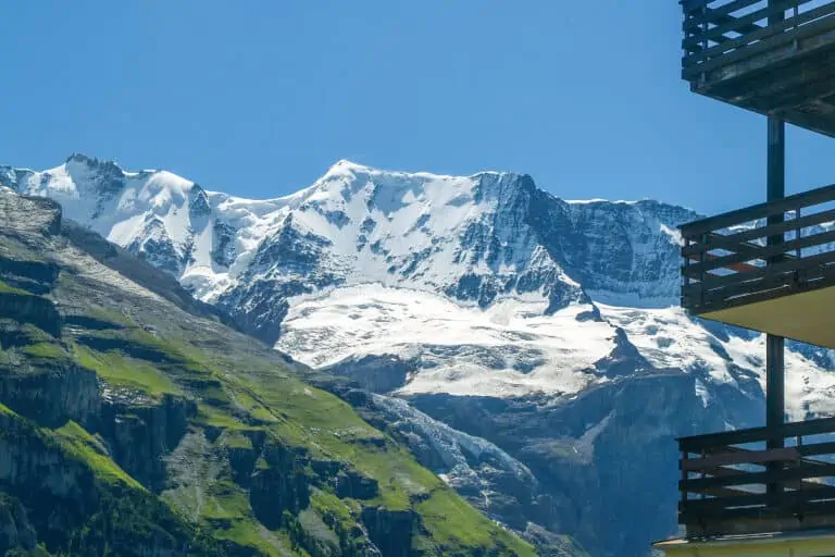
- The Jungfraujoch is the highest point you can reach in the Bernese Oberland. In summer, it gets 0°C to 5°C. In winter, count on -5°C to -10°C.
Apart from the effect of elevation, there are local weather variations caused by the mountain ranges that separate the valleys. So it may rain in the Simmen Valley, while skies are clear in the nearby Kander Valley.
Rain and snow
The Bernese Oberland is in a moist climate. Rain can occur year-long. The wettest months are May to August.
Don't let this put you off though. During our visits, we experience showers at the end of a warm summer day much more often than days of continuous rain.
Snowfall mostly occurs during winter, especially from late December to early March. Snow usually doesn't reach the lower areas of the Bernese Oberland, such as the towns on Lake Brienz and Lake Thun. So if you want a genuine snow holiday, we suggest you visit mountain villages and their ski areas.
5-day weather forecast for Interlaken
The Interlaken forecast is just an example. Weather can be very different in your base town or destination. So consult local, short-term forecasts for your specific plans.
Accommodation
Hotels versus holiday homes: what's best?
The Bernese Oberland is one of Switzerland's regions with a huge offer of holiday rentals, in addition to the many hotels. We recommend hotels if your stay in a town is relatively short, being less than 7 days or nights.
Holiday homes and chalets are often (but not always) rented by week. Saturday to Saturday is a common minimum rental period, especially in high-season months such as July and August.
So rentals are a good option if your stay in the Bernese Oberland is relatively long, and if you enjoy doing your own groceries and preparing your own meals.
Check the views
If you want to enjoy the beauty of the region right from your hotel room or chalet, make sure to check the views and pictures before booking. Being based in a scenic mountain village, such as Wengen, doesn't necessarily mean you'll have unobstructed views.
Hotel and holiday home overviews
Hotels in the Jungfrau Region, Switzerland
Hotels in the Bernese Oberland, Switzerland
Chalets and apartments in the Jungfrau Region
Why is the Bernese Oberland so famous?
We think the Bernese Oberland is popular for these 5 reasons:
- It’s incredibly diverse. You’ll see all sorts of scenery. There are friendly green valleys, such as the Simmen Valley, the Engstligen Valley and the Kander Valley. At the center are the large lakes of Thun and Brienz. And then there’s the Jungfrau Region with its stunning snow-capped mountains.
- There are plenty of activities for everyone and in every season. The Bernese Alps are great for winter sports. In summer, the region is perfect for boat trips, mountain biking, mountain visits, and hiking. Hiking trails range from easy valley walks to challenging alpine routes.
- The region is packed with a huge number of mountain peaks to visit. Each has its own views and charm. From the 360°C-views of the Niesen in the west, to the majestic Schilthorn in the middle, or the Alpen Tower near Meiringen with views of the Eiger in the east: they’re all beautiful.
- Public transport is excellent. It takes you to almost every place in the Bernese Oberland. There are countless cable cars, funiculars, gondolas and cogwheel trains ready to take you up to high-alpine scenery.
- The Bernese Oberland is picture-perfect in many places. The large altitude differences between valley floors and mountains result in wonderful scenery. You’ll see lush green meadows, rock walls, traditional Swiss villages and rugged peaks – all at the same time.


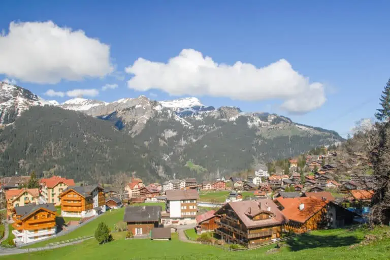
The sub-regions and towns of the Bernese Oberland
The Bernese Oberland is large and consists of several sub-regions, each with its own appeal. Roughly seen, from west to east, these regions are:
- The Simmen Valley: a friendly, typically Swiss green valley with half-timbered houses and forested mountains
- The Engstligen Valley: a green valley with the village of Adelboden, perfect for outdoor activities
- The Kander Valley: a valley that’s the gateway to the Valais, with impressive nature and the villages of Frutigen and Kandersteg
- Lake Thun: a wonderful blue lake, located directly west of Interlaken and with views of the Bernese Alps
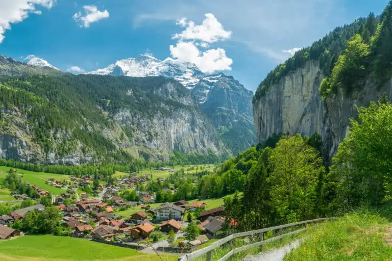
- The Jungfrau Region: the most spectacular part of the Bernese Oberland to many visitors, with the highest peaks and pretty mountain villages
- Lake Brienz: a picturesque lake east of Interlaken, somewhat smaller than Lake Thun, with steep mountain slopes
- The Hasli Valley: a wide valley with access to the Reichenbach Valley and Grindelwald, many more road passes, and Central Switzerland in the north
1. The Simmen Valley
Towns and landscape
The river Simme rises from several waterfalls in the mountains near the small town of Lenk. The river valley stretches out to Spiez, where it joins the river Kander and flows out in Lake Thun.
There are only a few larger towns in the valley.
- Zweisimmen is a scenic village with all basic facilities. To us, it makes a great base to explore the region.
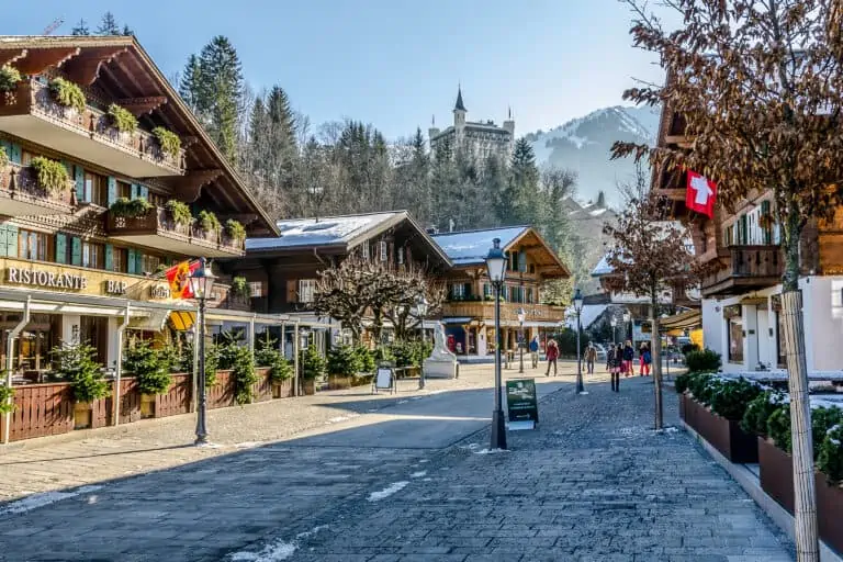
- Gstaad, not actually in the valley but part of the region, is a well-known town with luxury shops and hotels. It’s surrounded by a beautiful winter sports area.
- Lenk is in a southern side valley. The pretty village is famous for its waterfalls: the Simmenfälle and the so-called “Sibe Brunne” (“Seven wells”).
Must-do’s in the Simmen Valley
The GoldenPass line offers the best way to travel to and from the valley, and to make a day trip to Lake Geneva.
Mountain transportation allows you to start hiking and skiing or to simply enjoy the views up in the mountains. Examples:
- There’s the Rinderberg near Zweisimmen, and you’ll find several gondolas and chairlifts close to Gstaad.
- A visit to the Stockhorn is recommended, as it offers a magnificent view of the Alps in the south and the Swiss plateau with Bern in the north.
- The spectacular viewing point and sporty activities of Glacier 3000 can be well reached from the Simmen Valley.
2. The Engstligen Valley
What the Engstligen Valley is like
The valley starts near Frutigen in the Kander Valley. The 15 km long road to Adelboden is surrounded by slopes covered by forests and farms. Adelboden is the only village of the Engstligen Valley.
From Adelboden, several smaller practically car-free valleys stretch out to the mountains that mark the border between the Bernese Oberland and the Valais. It’s a magnificent region for hiking, biking, winter sports, and all sorts of outdoor activities.
There’s no railway in this valley, but there are frequent bus connections from Frutigen.
What to do around Adelboden
Several cable cars allow for mountain hikes, winter sports and other activities. You can reach the beautiful plains and waterfall of Engstlige by cable car for example. Other options are Tschentenalp and the Silleren-Hahnenmoos area with lots of hiking trails.
3. The Kander Valley
Location of the Kander Valley
The Kander Valley starts near Spiez at Lake Thun. The valley floor gradually gains height until the village of Kandersteg. The mighty peaks of the Alps here form the natural barrier between northern and southern Europe. The Balmhorn is the most prominent peak here.
There are several interesting side valleys, like the Kien Valley, the unspoilt Gastern Valley and the Engstligen Valley.
The scenery around Frutigen and Kandersteg
The northern part of the valley, around Frutigen, is quite wide. There are farms and the mountains are forested. Frutigen is a bit larger than Kandersteg further south. It has all main facilities and quick access to Lake Thun.
The southern part of the valley, around the smaller village of Kandersteg, is narrower and the mountains are higher. The valley ends behind Kandersteg, where the highest peaks rise up. Only hikers and trains can cross the mountains into the Valais. There is no road, but there is a car train.
What not to miss in the Kander Valley
The impressive railway from Bern to Italy runs through the Kander Valley. A tunnel connects Kandersteg to Goppenstein and Brig in the Valais. A longer tunnel starts in Frutigen, which is used by all fast InterCity trains.
We recommend a trip with the local Lötschberg Mountain Railway train from Spiez to Brig, through the older, shorter tunnel, as the scenery is very impressive.
In summer, a visit to Lake Oeschinen near Kandersteg is worth your time. So is a visit to the fairylike Blausee with its forest. For a panoramic view of the valley and the entire Bernese Oberland, you can plan a trip up the Niesen.
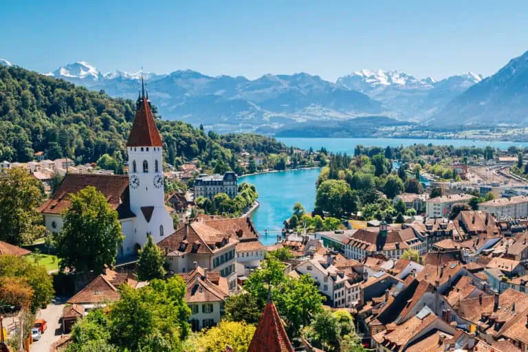
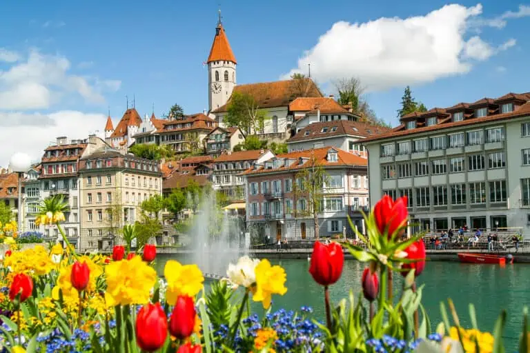
4. Lake Thun
Towns and landscape
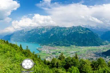
The name of the town of ‘Interlaken’ literally translates to ‘in between lakes’. One of these lakes is Lake Thun, named after the town on the western shore of the lake: Thun.
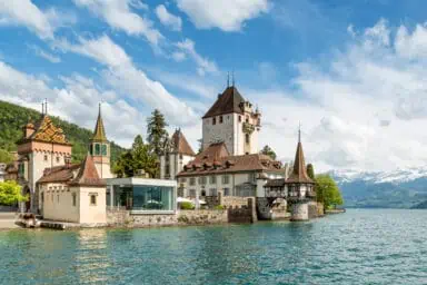
Steep forested slopes near Interlaken in the east merge into more gradual slopes in the west. The region borders the Jungfrau Region and the Kander Valley. One of the more prominent towns along the lake is Spiez, with an atmospheric little marina and ancient castle.
What not to miss around Lake Thun
A boat trip between Interlaken and Thun is a must. To enjoy the most impressive view of the lake, make a trip up the Niederhorn or the Niesen.
Find many more tips in our guide about Thun.
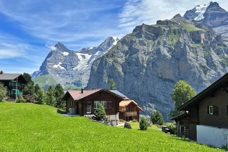
5. The Jungfrau Region
The Jungfrau Region is the most famous part of the Bernese Oberland. This is where you can find famous high peaks, such as the trio of Eiger, Mönch and Jungfrau. Mountain villages such as Wengen and Mürren are located here too.
We explain all about it in our Jungfrau Region guide.
6. Lake Brienz
Towns and landscape
This lake east of Interlaken is named after the main town along the eastern shore of the lake: Brienz. Steep forested slopes rise up from two sides of the lake. The region borders to the Jungfrau Region and the Hasli Valley.
What not to miss around Lake Brienz
We think that a boat trip between Interlaken and Brienz is a must. Include a stop at the impressive Giessbach Falls.
To enjoy the most impressive view of the lake, take the train up the Brienzer Rothorn. You may also like the woodcarving shops in Brienz.
The scenic GoldenPass line runs along the lake. A train ride is definitely the best way to get there.
7. The Hasli Valley
The Hasli Valley in short
The Hasli Valley, while part of the Bernese Oberland, is quite close to Lake Lucerne too. It makes a great base to explore both regions. There’s lots of nature all around: forests, lakes, high mountains and passes to the Jungfrau Region, Central Switzerland and the Valais.
Central location and many activities
Meiringen is the central town in the Hasli Valley. It’s located on the flat valley floor, with high mountains rising up on two sides. Great scenery is right next door: the Aare Gorge, where the river forces its way through the rocks, and the Reichenbach waterfall are at walking distance.
From Meiringen, you can explore a much larger region:
- Lake Brienz is a short train ride away.
- The south of Central Switzerland is quite close too: the GoldenPass trains offer a comfortable way to get there via the Brünig Pass. If you don’t mind a longer day trip, you can even visit Lake Lucerne.
- There are buses across several passes: the Susten Pass to Wassen in Central Switzerland, the Grimsel Pass to the Upper Rhone Valley in the Valais, and last but not least the Reichenbach Valley to Grosse Scheidegg and Grindelwald. Each of these bus or car routes makes for a scenic trip.
Viewing points to be reached by cable car include Käserstatt and Planplatten with its panoramic Alpen Tower restaurant.
West of Meiringen you’ll find the interesting Ballenberg open-air museum, with lots of historical information about Swiss culture and farm life.
Where to stay in the Bernese Oberland
The best central resorts
We think you should consider the below towns if you want to be located centrally, and if you prefer a mid-size town with quite some facilities:
- Thun or Spiez is best if you’re interested in Lake Thun, the western sub-regions of the Bernese Oberland, the city of Bern, and the three-lake region of Neuchâtel.
- Interlaken or nearby Wilderswil is a good choice if you want to be in the middle of the Bernese Oberland, with quick access to Lake Thun, Lake Brienz and the Jungfrau Region.
- Brienz or Meiringen is perfect if you want to see Lake Brienz, the many road passes south-east of Meiringen, the lakes of Lungern and Sarnen north of Brienz, and even Lake Lucerne. Brienz is small, but it has most facilities you’ll need as a tourist.
Our tips for lakeside towns
We prefer these towns for lake views:
- Thun, Spiez and the smaller village of Faulensee on Lake Thun. We also like the views from villages on the northern shore of the lake, for example Hünibach, Hilterfingen and Oberhofen. But since they can only be reached by bus and not by train, we like the southern Lake Thun shore a bit better.
- If you prefer staying at a campsite, consider Neuhaus, just west of Interlaken. It’s located beautifully on the eastern corner of Lake Thun.
- Goldswil, Ringgenberg or Brienz on Lake Brienz. These towns have a train station. We also like the views from the lakeside town Bönigen, which is directly east of Interlaken, and from Iseltwald on the southern shore. However, both of these towns have only bus connections and no train stations.
Mountain villages with great views
If mountain views directly from town are important to you, consider these options:
- We wouldn’t choose Beatenberg as a base town ourselves. This village on the northern hills of Lake Thun has to be reached by bus from Interlaken or Thun, and this takes additional time for each day trip. But if it comes to sweeping views, Beatenberg is amazing. You’ll look down on Lake Thun, Interlaken and part of Lake Brienz. And towering above all this are the Bernese Alps.
- Wengen and Mürren in the Jungfrau Region are close to the Bernese Alps and offer up-close views of the highest peaks. Grindelwald at the foot of the Eiger can be considered too. You’ll have good mountain views if your accommodation is a bit away from the town center, facing the south-west, and not obstructed by other buildings.
- If you like to be in a valley and look up to the mountains, consider Adelboden, Kandersteg, Lenk, or Lauterbrunnen.
Quieter resorts with fewer tourists
Some villages in the Bernese Oberland are popular and attract many tourists in summer and winter. If you prefer a somewhat less touristy town, we recommend you base yourself in one of the wonderful valleys of the western Bernese Oberland. Have a look at Zweisimmen, Adelboden, Lenk and Kandersteg for example.
We like Faulensee on Lake Thun too. It’s small, but its location is scenic. You’ll have decent bus connections toward both Spiez and Thun in the West, as well as toward Interlaken in the east.
Classy resorts with high-end accommodation
If you like some luxury, Gstaad is the place to be for you. 4- and 5-star accommodation is also available in several other towns such as Interlaken, Wengen and Grindelwald.
FAQ about the Bernese Oberland
-
How many days do I need for the Bernese Oberland?
We recommend a minimum of 3 days per sub-region of the Bernese Oberland. This allows you to get to know your surroundings, and to have several chances of visiting local mountain tops in good weather.
If you want to explore the entire Bernese Oberland well, we recommend a stay of at least 2 weeks. Even that is on the short side. You wouldn’t get bored during a 4-week stay in the Bernese Oberland either.
-
Is the Bernese Oberland the same as Bern?
No. Bern is the capital city of Switzerland. It’s also the name of the Swiss canton in which the city of Bern is located. The Bernese Oberland is the holiday region in the canton of Bern, south-east of the city of Bern.
-
Where is the Bernese Oberland?
The Bernese Oberland is located south-east of the Swiss capital city Bern, and roughly in the middle of Switzerland. It’s on the northern side of the large Bernese Alps mountain range.
From west to east, the region stretches out from Thun to Meiringen. The mountain ranges north of Lake Thun and Lake Brienz form the (imaginary) northern border. The Bernese Alps mark the south.
-
Where are the Bernese Alps located?
The Bernese Alps, or Bernese mountains, are south of the city Bern, and north of the Swiss canton of Valais. The Bernese Alps are a western part of the several mountain ranges, that together make up the Swiss Alps.
-
What does ‘Bernese Oberland’ mean?
In German, the region is called ‘Berner Oberland’. This literally translates into ‘the highlands of Bern’. The name is used to indicate the lake and mountain region south-east of the capital city of Bern. The entire region is in the large Swiss canton that’s also named ‘Bern’.
-
What does the Bernese Oberland look like?
The Bernese Oberland is located north of the highest peaks. That causes the climate to be cool and moist, at least when comparing it to the southern Alps. This results in a fresh green landscape.
The valley floors are mostly low (500 to 1,000 m), and peaks are high (up to 4,300 m). This great difference in altitude results in many climate zones and varying landscapes. During spring, it can feel like summer in the valleys and like winter up in the mountains.
Other websites of interest
- www.lenk-simmental.ch: Simmen Valley and Lenk Tourism
- www.kandersteg.ch: Kandersteg Tourism
- www.adelboden.ch: Frutigen-Adelboden Tourism
- www.thunersee.ch: Lake Thun Tourism
- www.brienzersee.ch: Lake Brienz Tourism
- www.haslital.swiss: Hasli Valley Tourism


More info about the towns in the Bernese Oberland
Interlaken
Mürren
Wengen
Grindelwald
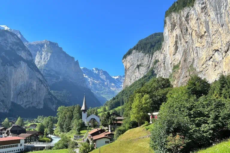
Lauterbrunnen
Thun
Gstaad
Itineraries that include the Bernese Oberland
Ultimate scenic trains
Best of the Alps
Scenic trains winter
What we write about the Bernese Oberland in our blog
Hike First-Grosse Scheidegg
Hike First-Bachsee