 Region: Valais
 Recommended season: early January to late April and early June to late October
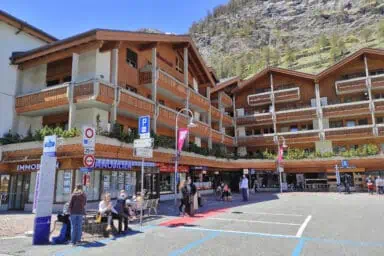
 This is a car-free town
 Altitude: 1605 m (5266 ft)
 This is a winter sports resort
 Town size: Small
 Local language: German
 There is a train station
Activities in Zermatt 
Find things to see and to in Zermatt
The 3 main mountains
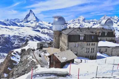
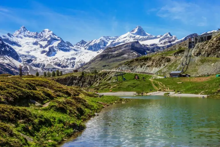
There are 3 wonderful mountain excursions to be made from Zermatt: to Gornergrat, Sunnegga-Rothorn, and Matterhorn Glacier Paradise. Not sure which one to choose? We'll help you out in our comparison guide!
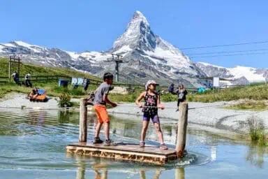
Summer activities in Zermatt
We recommend visiting one or several of the mountains from Zermatt, to enjoy views of the Matterhorn and the other peaks.
Summer is also the perfect time for hiking. Some of our favorites are:
- the easy and scenic walk from Furi to Zermatt;
- the hike from Riffelalp to Sunnegga;
- the route from Rotenboden to Riffelalp.
There's an extensive network of mountain bike trails near Zermatt as well.
Winter activities in Zermatt
There are lots of pistes for experienced skiers and snowboarders. But you’ll also find easy slopes and special classes for children and beginners.
Skiing and snowboarding aren’t the only way to enjoy the snow. You can go winter hiking and snowshoe hiking, or have snow fun by sledding, curling, and tobogganing. Winter paragliding is available too.
The nearby towns of Täsch, Randa, St. Niklaus and Grächen also have lots of pistes and winter activities. The ski area of Saas-Fee in the neighboring Saas Valley can be reached too, but a single trip takes about 2 hours.
Or simply watch the snow-capped peaks from mountains such as Gornergrat, Matterhorn Glacier Paradise and Sunnegga.
Bad-weather activities
Zermatt is all about outdoor activities, so we recommend sticking to those if possible. In case of bad weather, here's what else you can consider:
- The Matterhorn Museum "Zermatlantis" in Zermatt.
- A city trip to Brig.
- A city trip to Sion.
- City trips to Bern, Montreux or Lausanne. These are all pretty far away for a day trip though.
Traveling: reaching Zermatt, traveling in town, rail passes, mountain tickets, and map
How to reach Zermatt and how to travel in town: summary
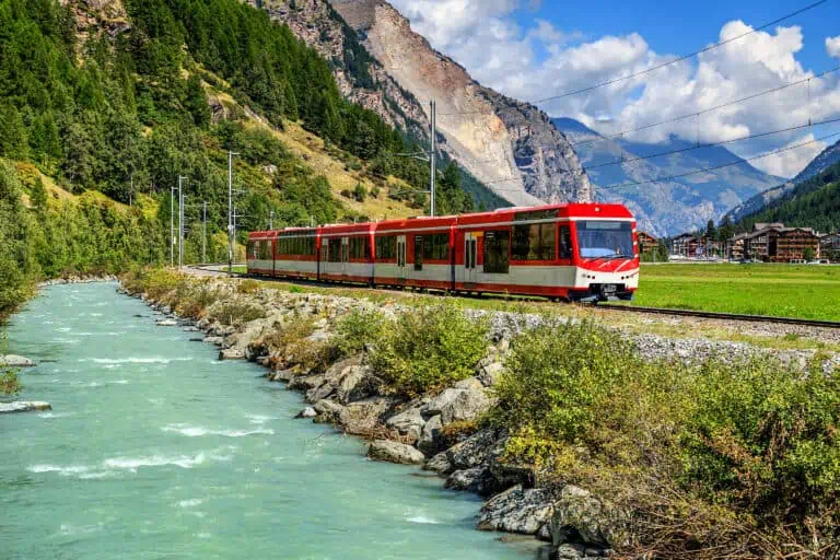
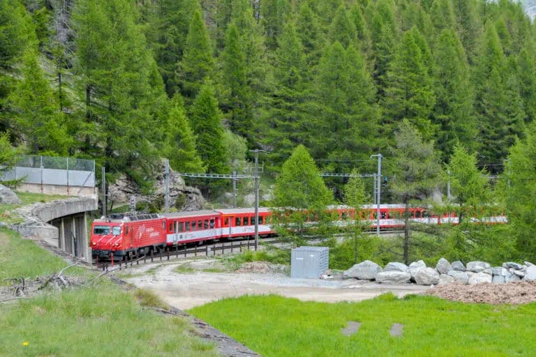
Zermatt can be reached by train only. Cars are not allowed into the village. The town is small and you can do everything on foot, but there are free electric buses too.
You can plan each trip to, from and in Zermatt with the aid of the Swiss timetable.
Which train station in Zermatt do you need?
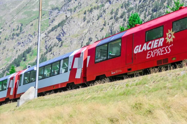
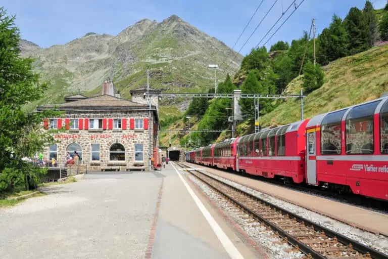
There are two rail stations in Zermatt. The regular train station, called "Zermatt" in the timetable, is where all trains arrive and depart. This includes the Glacier Express.
Just across the street there's the station for the cogwheel trains to the Gornergrat. This one's called "Zermatt GGB" in the timetable. "GGB" stands for "Gornergratbahn" (German for "Gornergrat Railway").
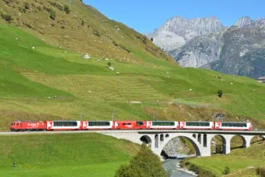
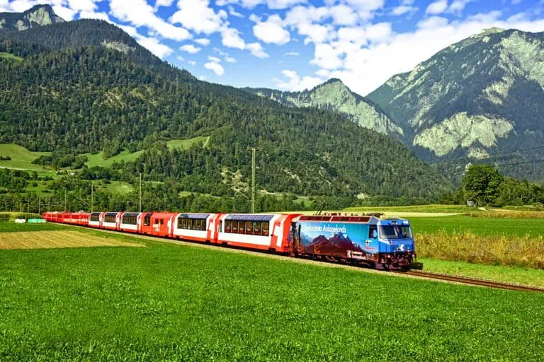
Reaching Zermatt by Glacier Express and normal trains
You can reach Zermatt with the famous Glacier Express, but there are plenty of regular local trains from Brig/Visp as well. These connect to trains coming from the Rhone Valley, Lake Geneva, and the Jungfrau Region (either through the Lötschberg Base Tunnel or by the scenic Lötschberg Mountain Railway).
Examples of train travel times to Zermatt
Zermatt is at the very southern end of the Matter Valley in the Valais, and it's close to the Italian border. It takes some time to get there from the Swiss airports and other towns. Examples of train travel durations:
- 3h30 from Zurich Airport, 3h15 from Zurich
- 3h45 from Basel EuroAirport, 3h20 from Basel
- 3h50 from Geneva Airport, 3h40 from Geneva
- 1h25 from Brig
- 2h05 to 2h20 (via the Lötschberg Base Tunnel) or 3h20 (by the Lötschberg Mountain Railway) from Interlaken
How to reach Zermatt by car and where to park
You can't drive all the way to the village. Drivers need to use the large parking facility in the nearby village Täsch. From there, frequent trains depart to Zermatt. The ride takes 10 minutes. There are trolleys to help you carry your luggage.
You can avoid the mountain road to Täsch by parking in Visp in the Rhone Valley instead, and taking the train from there.
Free electric buses in Zermatt
Electric buses are the public transport within Zermatt. As of April 2022, they are free for everyone to use. There are two bus lines:
- The red line "Winkelmatten": connecting the train station, the center of town and the Winkelmatten district.
- The green line "Bergbahnen": connecting the train station, the center of town and cableway/funicular stations.
On request, many hotels offer a free transfer to and from the rail station with their own vehicle.
Mountain transport from Zermatt
You can hike right into the mountains and use the cable cars, funiculars or trains. Most rail passes grant a discount on the tickets for mountain transport in Zermatt.
Rail passes suitable for Zermatt
- If you plan to visit other areas too, a nation-wide pass such as the Swiss Travel Pass or Swiss Half Fare Card can come in handy. Both provide a 50% discount on mountain rides from Zermatt.
- The Adventure Card can be a good choice if you want to travel in eastern Valais and western Graubünden for a limited number of days.
Find all rail pass options here.
All about the Peak2Peak ticket
What is the Peak2Peak ticket?
The Peak2Peak ticket is valid for a visit to both Gornergrat and Matterhorn Glacier Paradise in one day. It's not valid for Sunnegga-Rothorn. The tickets are available during the operation dates of the so-called "Riffelberg Express": from July to mid-August and from December to mid- or late April.
You need to follow a fixed route:
- First, you're traveling up to Matterhorn Glacier Paradise.
- Then you get back down, but not all the way to Zermatt. You'll change to a cable car at mid-station Furi: the "Riffelberg Express".
- This brings you to Riffelberg, where you board the cogwheel train to Gornergrat.
- After that, you take the train back to Zermatt.
You're also allowed to make this trip in reverse order, as long as you use the Riffelberg Express and not travel all the way down to Zermatt between both mountain visits.
Is the Peak2Peak ticket worth it?
If you plan to visit both mountains in one day, the Peak2Peak ticket is a good choice. It's cheaper than getting separate tickets.
A disadvantage is that you have to stick to this one particular route. We prefer to ride up and down as we like. Plus: the ticket is not available all year long.
Is the Peak2Peak ticket discounted with a Swiss Travel Pass and Swiss Half Fare Card?
Yes, the Swiss Travel Pass, Swiss Travel Pass Flex, and Swiss Half Fare Card provide a 50% discount. Show your pass when buying your ticket at a desk. Or choose the 'Reduced' option when ordering online.
All about the Peak Pass
What is the Peak Pass?
The Peak Pass allows free traveling to Gornergrat, Matterhorn Glacier Paradise and Sunnegga-Rothorn as often as you like. The trains between Zermatt, Täsch and Randa are included too. You can choose a number of days that fits your plans.
Is the Peak Pass worth it?
If you're staying in Zermatt for several days and plan to visit all three mountains (maybe even more than just once), the Peak Pass is worth it. For a short visit to Zermatt with excursions to just one or two of the mountains, we don't recommend buying a Peak Pass.
You may have a rail pass that already provides discounts on the mountains near Zermatt. Getting a Peak Pass might not be economical in that case.
Is the Peak Pass discounted with a Swiss Travel Pass and Swiss Half Fare Card?
Yes, the Swiss Travel Pass, Swiss Travel Pass Flex and Swiss Half Fare Card provide a 25% discount. Show your pass when buying your ticket at a desk.
Train rides from Zermatt
If you want to visit other parts of the Valais from Zermatt, you'll first have to travel to Visp (1h10 by train) or Brig (1h25 by train) in the Rhone Valley. From there, you can continue your journey in other directions.
The town of Zermatt on a map of Switzerland

Travel guides: popular routes from and to Zermatt explained
Zurich to Zermatt
Geneva to Zermatt
The best time to visit Zermatt
We prefer visiting Zermatt in early January to late April and early June to late October.
Zermatt in spring: April, May and June
April is still considered winter in the higher ski areas near Zermatt. Mountain transport may operate until mid- or even late April. The valley may look a bit dull in this month. There's little chance the villages are still snow-covered, and it can be bit too early to see spring setting in.
We absolutely love Zermatt in May. It's a beautiful month, with spring on its way and plenty of snow on the peaks. It is low season though. Gornergrat is accessible year-round, but transport to Sunnegga-Rothorn and Matterhorn Glacier Paradise won't operate due to maintenance breaks.
June is when the summer season for mountains near Zermatt starts. You'll get to do most outdoor activities, but the higher mountain trails may not be accessible yet due to snow.
Zermatt in summer: July, August and mid-September
July and August are the warmest months in Zermatt, usually with the least amount of snow on the peaks. Under normal circumstances, summer skiing should still be possible. But in warm summers the options may be very limited.
These are the perfect months for mountain biking and hiking.
Fall can start by mid-September. Temperatures will gradually drop and new snow can fall in the mountains. This process can start later too though, until well into October.
Zermatt in fall: October and November
October is still a good time to travel to Zermatt. Most mountain transport operates until mid- or late October. You can make beautiful valley hikes, enjoying the autumn colors and the snowy peaks.
November is low season. Not all mountaintops are accessible. The valley can look somewhat grey and brown.
Christmas in Zermatt: December
Zermatt is a nice Christmas destination. You can enjoy dining and shopping in the illuminated main street. From mid-December, there’s a large Christmas tree that’s lit during a ceremony. Don’t expect a large Christmas market or holiday festivals.
The winter and ski season starts in December, so most cable cars and mountain trains will be running. Weather-dependent, the start of the ski season may be postponed.
Zermatt during winter: January to March
Zermatt is perfect for winter activities in December, January, February and March. Snowfall is likely in town, and almost guaranteed on the surrounding mountains.
What weather in Zermatt is like
How warm does it get in Zermatt?
Zermatt is one of the higher mountain villages of Switzerland. Temperatures are relatively low here: average daytime temperatures range from 10°C to 16°C in summer. It can feel much warmer if it's sunny and windless though.
How cold does it get in Zermatt?
During the day, you should count on temperatures between 0°C to 5°C in winter. Frost during winter nights, with temperatures between 0°C and -5°C, is very common.
Does it rain in Zermatt?
Rainfall can occur year-round in Zermatt. The wettest months are April to August, and November.
The amount and type of rainfall are unpredictable: weather in the Swiss Alps is changeable. Showers and sunny spells may alternate in Zermatt over the day, but longer rainy or sunny spells are no exception either.
Does it snow in Zermatt?
Due to Zermatt's high elevation, snow in town is very likely in the coldest months: December, January and February. It's no absolute guarantee though.
The high ski and snow areas around Zermatt are pretty snow-sure.
5-day weather forecast for Zermatt
Accommodation in Zermatt
Rental chalets versus hotels in Zermatt
Zermatt has a large offer of rental chalets and apartments. This can be a way to reduce costs: you can do your own groceries in the several supermarkets in town, including the Coop across from the railway station.
We prefer a holiday home or chalet if we spend a week or more in Zermatt, as this type of accommodation is often rented by the week.
For a quick visit of just a couple of nights, we normally book a hotel. Although there are several luxurious and expensive hotels, mid-range and budget accommodation is available too. And most are within walking distance from the rail stations.
A special experience: hotels in the mountains of Zermatt
It's a magical experience to spend a night in the mountains, and to watch sunset and sunrise over the Alps of the Valais. Have a look at the Gornergrat Kulmhotel, the Riffelalp Resort, or Hotel Silvana at Furi. Find other mountain hotels in Switzerland here.

Check price & details:
Zermatt hotel and holiday homes overviews
Find your hotel in Zermatt: from budget to luxury
Holiday homes and apartments in Zermatt, Switzerland
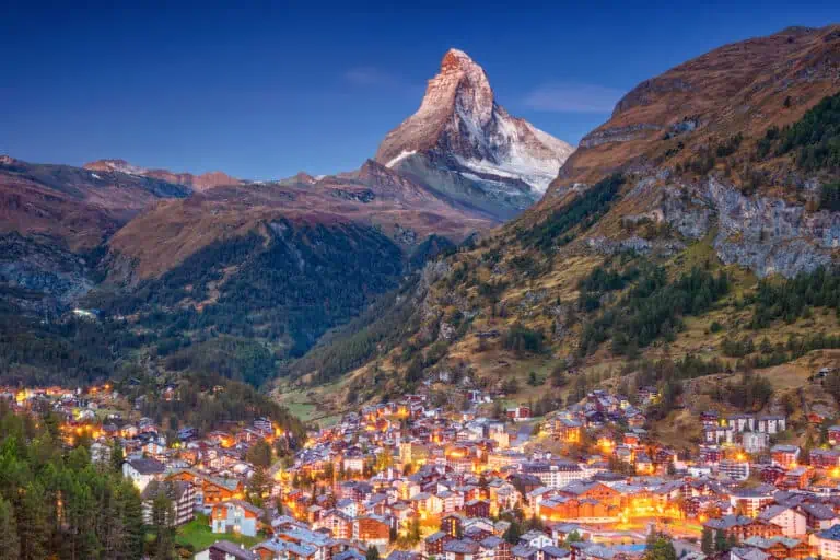
What is Zermatt like?
A perfect alpine village
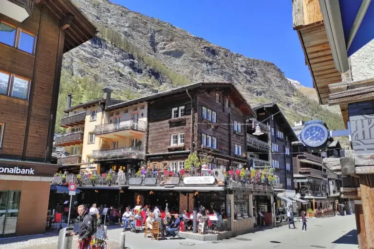
Zermatt is the ideal place for anyone who is looking for perfection: a car-free village in an amazing landscape with the best shops, hotels, restaurants and chalets.
If you’ve never been to Switzerland, a picture-perfect town like Zermatt is probably what you have in mind when thinking about your first visit. It is easy to reach by the world-famous Glacier Express!
Location and scenery
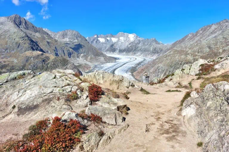
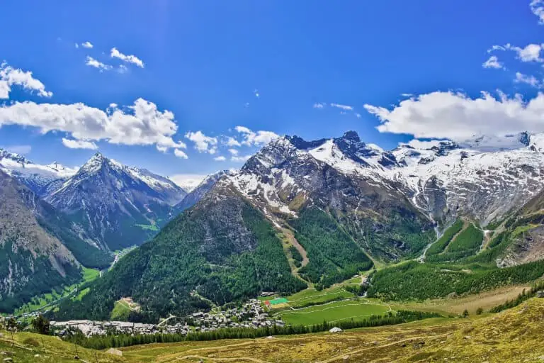
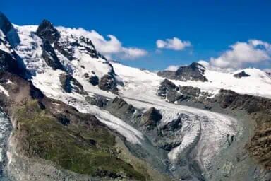
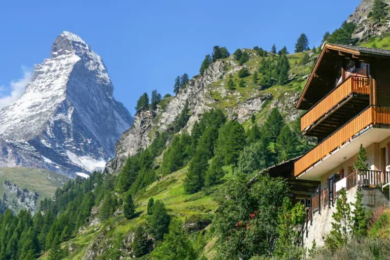
Zermatt is situated at the end of the Matter Valley in the canton of Valais, at one of the most scenic spots in Switzerland. The highest peaks of the Alps can be found here. The most prominent one is the famous Matterhorn.
The town is located at a high altitude and is surrounded by mountains, conifer forests, and ski slopes. It has its own microclimate, which may or may not work out in your favor.
Pros and cons of Zermatt
Stunning nature
The alpine scenery ranks at the absolute top of the Swiss Alps. The car-free village offers a relaxed way to enjoy nature in peace and quiet.
A touristy village
Zermatt itself is a tourist hotspot, especially in summer and winter months. To some, it’s too touristy.
Dependent on weather
The mountains either block clouds from coming in or keep them in one place. It can rain for days or not at all for weeks. You’d best be prepared for anything. Zermatt is perfect for outdoor activities, but if weather is bad, the isolated location makes it time-consuming to go somewhere else.
If you don’t mind a full day of traveling, you can consider trips to the Upper Rhone Valley near Brig, or even the Jungfrau Region.
Popular with high-end accommodation
Zermatt is popular with many tourists, so this isn’t a low-budget destination. But you can find affordable options: check our budget hotel selection.
FAQ about Zermatt
-
Where is Zermatt located?
Zermatt is located in the Swiss canton Valais. It’s on the southern end of the Matter Valley, close to the Italian border.
Zermatt is a 3h15 train ride from Zurich and a 3h40 journey from Geneva.
-
What is Zermatt famous for?
Zermatt is famous for its location at the foot of the iconic mountain Matterhorn. You can view the Matterhorn from several mountains that are accessible by cogwheel train (Gornergrat) and other transport (Matterhorn Glacier Paradise and Sunnegga-Rothorn).
Many more high and impressive Swiss peaks surround the village. The overall scenery is amazing.
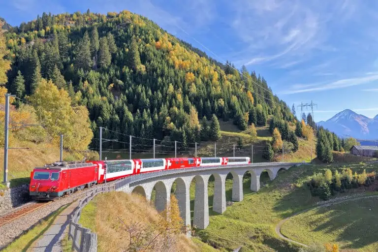
Zermatt is also at one end of the famous panoramic Glacier Express train route.
-
Is Zermatt in Switzerland worth visiting?
Yes, Zermatt is certainly worth your time. Even if you feel the village is too touristy, its beautiful mountain scenery deserves at least a day trip.
-
Is Zermatt car-free?
Yes, Zermatt is car-free. Only small electric buses ride in the village.
You can’t reach Zermatt by car either. You’ll have to park in the nearby village Täsch and continue to Zermatt by train.
-
Are the buses in Zermatt free?
Yes, the electric buses in Zermatt are free for everyone from April 2022.
-
How many days to spend in Zermatt?
If it fits your itinerary, include at least 1 full day in Zermatt. This allows you to stroll around town, and to do one or two mountain excursions.
If you want to properly enjoy the mountains and the many restaurants in town, stay for at least 3 or 4 days.
-
Interlaken or Zermatt: where to stay?
We advise Interlaken if you want a central base from which you can travel in several directions, such as Lake Thun, Lake Brienz, Bern, Lucerne and the Jungfrau Region. It’s also directly on the GoldenPass train route.
Zermatt is better if you want to see the Matterhorn, if you prefer an authentic village with traditional Swiss chalets, if you want to stay right within the mountains, or if you travel by Glacier Express.
-
Grindelwald or Zermatt: where to stay?
Grindelwald is a better choice if the Bernese Oberland and the Jungfrau Region (with famous activities such as the Schilthorn and Jungfraujoch) are on your wish list.
Grindelwald is also located more centrally than Zermatt: in 35 minutes you’re in Interlaken, from where you can travel in several directions.
Zermatt is recommended if you want to see the Matterhorn, if you don’t mind a somewhat isolated location, and if your itinerary includes the Valais or the Glacier Express train journey.
-
St. Moritz or Zermatt: which is better?
Both St. Moritz and Zermatt, at both ends of the Glacier Express, are attractive small mountain villages. We help you choose in our Zermatt versus St. Moritz comparison.
-
How to fly to Zermatt?
The Swiss airport closest to Zermatt (in terms of traveling time) is Zurich Airport. A train ride to Zermatt takes 3h30.
The travel differences with other Swiss airports are small: it’s a 3h45 train journey from Basel EuroAirport, and a 3h50 ride from Geneva Airport.
Other websites of interest
- www.matterhornparadise.ch: Zermatt summer skiing
- www.e-bus.ch: Zermatt bus timetable
- www.zermatt.ch: free bus rides in Zermatt
- www.matterhorngotthardbahn.ch: car park in Täsch near Zermatt
- www.zermatt.ch: Zermatlantis Museum
Prices
- www.matterhornparadise.ch: Peak2Peak ticket
- www.matterhornparadise.ch: Peak Pass
Itineraries including Zermatt
Glacier Express: 3-day classic tour from Zurich
Glacier Express: 4-day slow-paced tour from Zurich
Ultimate scenic trains
Zermatt in our blog
Gornergrat, Matterhorn Glacier Paradise, Sunnegga-Rothorn
Hike Täsch-Zermatt